IMAGES TAKEN NEAR TO
Folds Street, BURNLEY, BB12 0AL
Introduction
This page details the photographs taken nearby to Folds Street, BB12 0AL by members of the Geograph project.
The Geograph project started in 2005 with the aim of publishing, organising and preserving representative images for every square kilometre of Great Britain, Ireland and the Isle of Man.

There are currently over 7.5m images from over14,400 individuals and you can help contribute to the project by visiting https://www.geograph.org.uk
Image Map (Loading...)


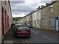
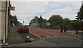
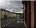
Getting Data...Please wait
Leaflet Map data © OpenStreetMap
Images are licensed for reuse under creativecommons.org/licenses/by-sa/2.0
Notes
- Clicking on the map will re-center to the selected point.
- The higher the marker number, the further away the image location is from the centre of the postcode.
Image Listing (128 Images Found)
Images are licensed for reuse under creativecommons.org/licenses/by-sa/2.0
Image
Details
Distance
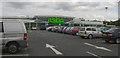
1

The Shah Jalal Masjid mosque
Taken from the ASDA carpark
Image: © Ian Greig
Taken: 13 May 2016
0.01 miles
2

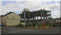
Unfinished mosque in Stoneyholme, Burnley
Image: © Alexander P Kapp
Taken: 16 Oct 2012
0.03 miles
4

Pakistan and Bangladesh General Store, 117 Bougham Street
Image: © Robert Wade
Taken: 8 Jul 2009
0.06 miles
7
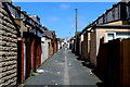
Back Alley between Cromwell Street and Gordon Street
Image: © Chris Heaton
Taken: 2 Jun 2016
0.08 miles
8
Shah Jalal Mosque, Burnley
From the Asda car park
Image: © Robert Wade
Taken: 8 Jul 2009
0.08 miles