IMAGES TAKEN NEAR TO
Whitendale Crescent, BLACKBURN, BB1 1RZ
Introduction
This page details the photographs taken nearby to Whitendale Crescent, BB1 1RZ by members of the Geograph project.
The Geograph project started in 2005 with the aim of publishing, organising and preserving representative images for every square kilometre of Great Britain, Ireland and the Isle of Man.

There are currently over 7.5m images from over14,400 individuals and you can help contribute to the project by visiting https://www.geograph.org.uk
Image Map
Images are licensed for reuse under creativecommons.org/licenses/by-sa/2.0
Notes
- Clicking on the map will re-center to the selected point.
- The higher the marker number, the further away the image location is from the centre of the postcode.
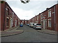
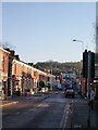
Image Listing (18 Images Found)
Images are licensed for reuse under creativecommons.org/licenses/by-sa/2.0
Image
Details
Distance
1
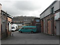
Industrial Units - Dickens Street, Blackburn
Image: © Anthony Parkes
Taken: 26 Feb 2011
0.11 miles
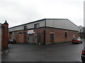
3
Former golf driving range off Haslingden Road
Image: © Alexander P Kapp
Taken: 30 Sep 2010
0.15 miles
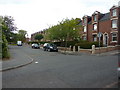
8
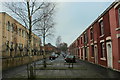
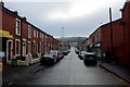
Walter Street, Blackburn
In the Blackburn suburb of Higher Audley - on the left is a mosque and to right traditional terraced housing.
Image: © Chris Heaton
Taken: 20 Jan 2019
0.21 miles
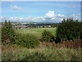
10
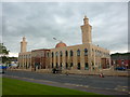
Mosque on Audley Range, Blackburn
Image: © Alexander P Kapp
Taken: 17 Jun 2011
0.22 miles