IMAGES TAKEN NEAR TO
Hameldon Road, BURNLEY, BB11 5QW

Introduction

This page details the photographs taken nearby to Hameldon Road, BB11 5QW by members of the Geograph project.

The Geograph project started in 2005 with the aim of publishing, organising and preserving representative images for every square kilometre of Great Britain, Ireland and the Isle of Man.

There are currently over 7.5m images from over14,400 individuals and you can help contribute to the project by visiting https://www.geograph.org.uk

Image Map


Images are licensed for reuse under creativecommons.org/licenses/by-sa/2.0
Notes
  • Clicking on the map will re-center to the selected point.
  • The higher the marker number, the further away the image location is from the centre of the postcode.

Image Listing (23 Images Found)

Images are licensed for reuse under creativecommons.org/licenses/by-sa/2.0
  • ...
Image
Details
Distance
1
Hapton, Lancashire
Image: © Robert Wade Taken: 30 Aug 2010
0.04 miles
2
Path crossing Hameldon Road
Image: © Raymond Knapman Taken: 18 Nov 2013
0.13 miles
3
Former Thornybank Colliery, Hapton
Which closed in 1968. http://www.jnadin1.50megs.com/custom.html
Image: © Alexander P Kapp Taken: 3 Feb 2009
0.13 miles
4
The Hapton Inn
Image: © Ian Greig Taken: 20 Jul 2018
0.15 miles
5
The Hapton Inn
This public house is situated at the junction of Burnley Road and Accrinton Road
Image: © Alexander P Kapp Taken: 16 Jan 2006
0.15 miles
6
Burnley Road, Hapton
Image: © Alexander P Kapp Taken: 3 Feb 2009
0.15 miles
7
Former Hapton Valley Coal Mine, Steps
These steps lead nowhere, when the mine was active they would have been used for access to the building on the right.
Image: © Alexander P Kapp Taken: 3 Feb 2009
0.15 miles
8
Hapton Inn, Lane Ends
Image: © David Dixon Taken: 12 Apr 2012
0.16 miles
9
The Hapton Inn, Lane Ends
Image: © JThomas Taken: 26 Nov 2016
0.16 miles
10
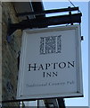
Sign for the Hapton Inn, Lane Ends
Image: © JThomas Taken: 26 Nov 2016
0.17 miles
  • ...