IMAGES TAKEN NEAR TO
Cemetery Lane, BURNLEY, BB11 5QB
Introduction
This page details the photographs taken nearby to Cemetery Lane, BB11 5QB by members of the Geograph project.
The Geograph project started in 2005 with the aim of publishing, organising and preserving representative images for every square kilometre of Great Britain, Ireland and the Isle of Man.

There are currently over 7.5m images from over14,400 individuals and you can help contribute to the project by visiting https://www.geograph.org.uk
Image Map (Loading...)


Getting Data...Please wait
Leaflet Map data © OpenStreetMap
Images are licensed for reuse under creativecommons.org/licenses/by-sa/2.0
Notes
- Clicking on the map will re-center to the selected point.
- The higher the marker number, the further away the image location is from the centre of the postcode.
Image Listing (24 Images Found)
Images are licensed for reuse under creativecommons.org/licenses/by-sa/2.0
Image
Details
Distance
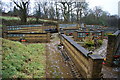
7
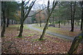
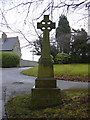
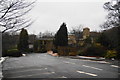
Woodland walk by Burnley Crematorium
Part of the crematorium grounds.
Image: © Bill Boaden
Taken: 28 Dec 2010
0.15 miles
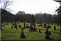
9
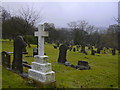
The memorial plaques, Burnley Crematorium
Image: © Bill Boaden
Taken: 28 Dec 2010
0.18 miles
10
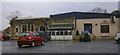
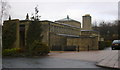
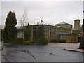
Rosegrove Unity W.M.C. Holme Lodge Rossendale Road Burnley
Image: © Robert Wade
Taken: 25 Feb 2010
0.19 miles