IMAGES TAKEN NEAR TO
Manchester Road, BURNLEY, BB11 5NS

Introduction

This page details the photographs taken nearby to Manchester Road, BB11 5NS by members of the Geograph project.

The Geograph project started in 2005 with the aim of publishing, organising and preserving representative images for every square kilometre of Great Britain, Ireland and the Isle of Man.

There are currently over 7.5m images from over14,400 individuals and you can help contribute to the project by visiting https://www.geograph.org.uk

Image Map


Images are licensed for reuse under creativecommons.org/licenses/by-sa/2.0
Notes
  • Clicking on the map will re-center to the selected point.
  • The higher the marker number, the further away the image location is from the centre of the postcode.

Image Listing (20 Images Found)

Images are licensed for reuse under creativecommons.org/licenses/by-sa/2.0
Image
Details
Distance
1
A682, Manchester Road
Looking downhill, towards Burnley
Image: © David Dixon Taken: 7 Oct 2010
0.04 miles
2
Steep descent on Manchester Road (A682)
Looking north - downhill all the way to Burnley.
Image: © JThomas Taken: 25 Sep 2018
0.08 miles
3
Grazing near Higher Oaken Eaves
West of Manchester Road (A682).
Image: © JThomas Taken: 25 Sep 2018
0.08 miles
4
Farm next to A56
Image: © Richard Spencer Taken: 18 Feb 2006
0.09 miles
5
Higher Micklehurst
Image: © JThomas Taken: 25 Sep 2018
0.09 miles
6
Digger clearing snowdrifts A682
The drifting of snow on this road was prevented by the erection of snow fences just a few metres inside the boundary walls. These snow fences fell into disrepair and were eventually removed. Now the snow drifts are back.
Image: © Chris Tomlinson Taken: 23 Mar 2013
0.11 miles
7
Farm buildings, Higher Micklehurst Barn
Image: © JThomas Taken: 25 Sep 2018
0.17 miles
8
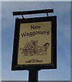
Sign for the New Waggoners
Image: © JThomas Taken: 25 Sep 2018
0.19 miles
9
Burnley: The 'Waggoners', Manchester Road
A bleak, almost moorland, situation with no real local catchment area. It is, however, near to the Burnley Way long-distance footpath, and there is a bus route (the X43, Witch Way, Nelson to Manchester route passes here). Also there is a large car park for passing trade or those willing to risk the breathalyser. There is real ale and food available here also.
Image: © Dr Neil Clifton Taken: 14 Oct 2012
0.21 miles
10
Grazing near the New Waggoners
View towards Nutshaw Hill.
Image: © JThomas Taken: 25 Sep 2018
0.21 miles