
IMAGES TAKEN NEAR TO
Cog Lane, BURNLEY, BB11 5JS
Introduction
This page details the photographs taken nearby to Cog Lane, BB11 5JS by members of the Geograph project.
The Geograph project started in 2005 with the aim of publishing, organising and preserving representative images for every square kilometre of Great Britain, Ireland and the Isle of Man.

There are currently over 7.5m images from over14,400 individuals and you can help contribute to the project by visiting https://www.geograph.org.uk
Image Map
Images are licensed for reuse under creativecommons.org/licenses/by-sa/2.0
Notes
- Clicking on the map will re-center to the selected point.
- The higher the marker number, the further away the image location is from the centre of the postcode.
Image Listing (14 Images Found)
Images are licensed for reuse under creativecommons.org/licenses/by-sa/2.0
Image
Details
Distance
1
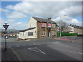
Up for sale
Former pub on the junction of Coal Clough Lane and Cog Lane. Update as of 23rd November 2012. It has been knocked down and it is proposed to build six bungalows on the site
Image: © Alexander P Kapp
Taken: 20 Apr 2010
0.06 miles
2
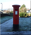
George VI postbox on Coal Clough Lane
Postbox No. BB11 101.
See Image] for context.
Image: © JThomas
Taken: 26 Nov 2016
0.06 miles
3
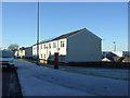
Houses on Coal Clough Lane
Showing position of Postbox No. BB11 101.
See Image] for postbox.
Image: © JThomas
Taken: 26 Nov 2016
0.07 miles
4
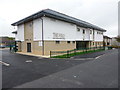
The Fold, Centre for Integrated Health and Wellbeing, Venice Avenue, Burnley
Image: © Alexander P Kapp
Taken: 20 Sep 2011
0.08 miles
5
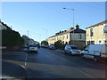
Coal Clough Lane, Burnley
Looking south west.
Image: © JThomas
Taken: 26 Nov 2016
0.10 miles
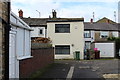
7

Derelict council houses, Milan Avenue, Burnley, Lancashire
The post-WWII Council housing estate of Bleak House, Burnley, was not popular with tenants as problems began to multiply. The houses had been very badly built, there was ingress of water, structural problems - and the rats began to move in. In the end, no-one could be found willing to occupy the houses, and the Council was left with no alternative than to demolish them. Some were actually set on fire, so as to make a training film for the Fire department.
The road, Milan Avenue, was expunged from the map, which is why I am unable to provide an exact grid reference: other roads of the estate do survive and have names after Italian cities such as Genoa and Rome.
Image: © Dr Neil Clifton
Taken: 29 Jul 1988
0.11 miles
8
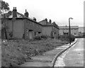
Derelict Council houses, Milan Avenue, Burnley, Lancashire (2)
See Image
Image: © Dr Neil Clifton
Taken: 29 Jul 1988
0.11 miles
9
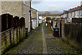
Alleyway between Cog Lane and Bristol Street, Burnley
Image: © Chris Heaton
Taken: 4 Mar 2017
0.15 miles
10

Parkside Methodist Church, Cog Lane, Burnley
Image: © Alexander P Kapp
Taken: 18 Apr 2006
0.15 miles