
IMAGES TAKEN NEAR TO
Carlton Road, BURNLEY, BB11 4JE
Introduction
This page details the photographs taken nearby to Carlton Road, BB11 4JE by members of the Geograph project.
The Geograph project started in 2005 with the aim of publishing, organising and preserving representative images for every square kilometre of Great Britain, Ireland and the Isle of Man.

There are currently over 7.5m images from over14,400 individuals and you can help contribute to the project by visiting https://www.geograph.org.uk
Image Map
Images are licensed for reuse under creativecommons.org/licenses/by-sa/2.0
Notes
- Clicking on the map will re-center to the selected point.
- The higher the marker number, the further away the image location is from the centre of the postcode.
Image Listing (136 Images Found)
Images are licensed for reuse under creativecommons.org/licenses/by-sa/2.0
Image
Details
Distance
1
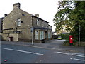
Houses on Carlton Road, Burnley
Showing position of Postbox No. BB11 4.
See Image] for postbox.
Image: © JThomas
Taken: 25 Sep 2018
0.04 miles
2
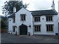
Greenhill House
Greenhill is an 18th Century, Grade 2 listed building. It was constructed in about 1720 on the site of a Medieval Farmhouse. It originally stood in open fields. For around 80 years it has been used as a Bowling Club.
Image: © Chris Tomlinson
Taken: 28 Aug 2009
0.05 miles
3
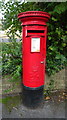
Elizabeth II postbox on Manchester Road, Burnley
Postbox No. BB11 4.
See Image] for context.
Image: © JThomas
Taken: 25 Sep 2018
0.05 miles
4

Spire of demolished Manchester Road Methodist Church
View from Healey Mount of that remains of the church. The spire is an Ordnance Survey intersected station trig point, https://trigpointing.uk/trig/14658
Image: © Roger Templeman
Taken: 24 Apr 2025
0.07 miles
5
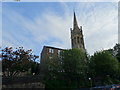
Wesleyan Methodist Church, Burnley
Only the steeple remains.
Image: © JThomas
Taken: 25 Sep 2018
0.07 miles
6
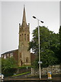
Former church spire off Manchester Road
Image: © Alexander P Kapp
Taken: 1 Sep 2009
0.09 miles
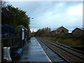
8
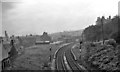
Burnley (Manchester Road) Station
View eastward, towards Todmorden; ex-Lancashire & Yorkshire, Burnley (Gannow Junction) - Todmorden main line. This station was closed on 6/11/61 (goods 2/4/63), but a new station was opened nearby on 29/9/86.
Image: © Ben Brooksbank
Taken: 22 Sep 1962
0.11 miles
9
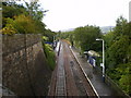
Manchester Road Station
On the Blackburn to Todmorden Railway, looking west towards Blackburn
Image: © Alexander P Kapp
Taken: 1 Sep 2009
0.11 miles
10
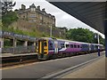
Train at Platform 1
Looking across Burnley Manchester Road station. The train is a class 158 bound for Blackpool North.
Image: © DS Pugh
Taken: 24 Jul 2019
0.11 miles