IMAGES TAKEN NEAR TO
Clevelands Mount, BURNLEY, BB11 4HA

Introduction

This page details the photographs taken nearby to Clevelands Mount, BB11 4HA by members of the Geograph project.

The Geograph project started in 2005 with the aim of publishing, organising and preserving representative images for every square kilometre of Great Britain, Ireland and the Isle of Man.

There are currently over 7.5m images from over14,400 individuals and you can help contribute to the project by visiting https://www.geograph.org.uk

Image Map


Images are licensed for reuse under creativecommons.org/licenses/by-sa/2.0
Notes
  • Clicking on the map will re-center to the selected point.
  • The higher the marker number, the further away the image location is from the centre of the postcode.

Image Listing (72 Images Found)

Images are licensed for reuse under creativecommons.org/licenses/by-sa/2.0
  • ...
Image
Details
Distance
1
Greenhill House
Greenhill is an 18th Century, Grade 2 listed building. It was constructed in about 1720 on the site of a Medieval Farmhouse. It originally stood in open fields. For around 80 years it has been used as a Bowling Club.
Image: © Chris Tomlinson Taken: 28 Aug 2009
0.07 miles
2
War Memorial at St Matthew's Church
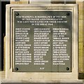
One of the features of the outside of Image] is the War Memorial, which commemorates the men of the parish who died in the First World War, including one Victoria Cross. The dedication reads: IN THANKFUL REMEMBRANCE OF THE MEN OF THIS PARISH AND CONGREGATION WHO GAVE THEIR LIVES FOR THEIR COUNTRY IN THE GREAT WAR Image]
Image: © David Dixon Taken: 15 Feb 2015
0.07 miles
3
War Memorial Dedication, St Matthew's Church
The dedication on Image] was restored in 2013 IN THANKFUL REMEMBRANCE OF THE MEN OF THIS PARISH AND CONGREGATION WHO GAVE THEIR LIVES FOR THEIR COUNTRY IN THE GREAT WAR
Image: © David Dixon Taken: 15 Feb 2015
0.07 miles
4
Mount Road, Burnley
Image: © Alexander P Kapp Taken: 30 Jun 2010
0.07 miles
5
The Parish Church of St Matthew with Holy Trinity Habergham Eaves, Burnley
St Matthew's Church is the parish church for the old village of Habergham Eaves which stretches from Crown Point to the Trafalgar roundabout near Burnley town centre. The original church was built between 1876 and 1879 in the style of the 13th century but it was destroyed by a fire on Christmas Day 1927 which left only the walls standing. It was rebuilt between 1929 and 1931. St Matthew's integrated with Holy Trinity Church in the 1970s. http://www.stmatthewsburnley.co.uk/history-of-st-matthew-s-and-holy-trinity History of St Matthew's and Holy Trinity (church web site)
Image: © David Dixon Taken: 15 Feb 2015
0.08 miles
6
The Former Sunnybank School, Manchester Road
Formerly a private school it has now been converted to flats.
Image: © Robert Wade Taken: 1 Jul 2008
0.08 miles
7
Wesleyan Methodist Church, Burnley
Only the steeple remains.
Image: © JThomas Taken: 25 Sep 2018
0.09 miles
8
Former church spire off Manchester Road
Image: © Alexander P Kapp Taken: 1 Sep 2009
0.09 miles
9
Houses on Carlton Road, Burnley
Showing position of Postbox No. BB11 4. See Image] for postbox.
Image: © JThomas Taken: 25 Sep 2018
0.10 miles
10
Elizabeth II postbox on Manchester Road, Burnley
Postbox No. BB11 51.
Image: © JThomas Taken: 25 Sep 2018
0.11 miles
  • ...