
IMAGES TAKEN NEAR TO
Crown Point Road, BURNLEY, BB11 3RT
Introduction
This page details the photographs taken nearby to Crown Point Road, BB11 3RT by members of the Geograph project.
The Geograph project started in 2005 with the aim of publishing, organising and preserving representative images for every square kilometre of Great Britain, Ireland and the Isle of Man.

There are currently over 7.5m images from over14,400 individuals and you can help contribute to the project by visiting https://www.geograph.org.uk
Image Map
Images are licensed for reuse under creativecommons.org/licenses/by-sa/2.0
Notes
- Clicking on the map will re-center to the selected point.
- The higher the marker number, the further away the image location is from the centre of the postcode.
Image Listing (25 Images Found)
Images are licensed for reuse under creativecommons.org/licenses/by-sa/2.0
Image
Details
Distance
1
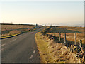
Crown Point Road
Moorland Road to the south of Burnley.
Image: © David Dixon
Taken: 19 Feb 2013
0.11 miles
3
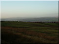
To Padiham and Whalley
Taken on Crown Point Road, I am looking towards Longridge Fell and the Nick of Pendle with Padiham and Whalley visible in the middle distance.
Image: © Carroll Pierce
Taken: 31 Dec 2013
0.12 miles
4
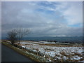
Pendle Hill
Taken from Crown Point Road where it meets Woodplumpton Road, Burnley.
Image: © Carroll Pierce
Taken: 17 Mar 2013
0.13 miles
5
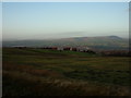
The Forest of Pendle
The Forest of Pendle and its gloriously dominant hill, taken from Crown Point Road to the south of Burnley, Lancashire.
Image: © Carroll Pierce
Taken: 31 Dec 2013
0.13 miles
6
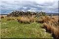
Distressed Wall beside The Burnley Way
Wall passed between Crown Point Road and the A682, Manchester Road
Image: © Chris Heaton
Taken: 29 Apr 2018
0.15 miles
7
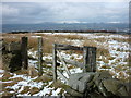
Pendle Hill from Crown Point Road
Taken on my way up Crown Point Road, Burnley, to the Singing Ringing Tree.
Image: © Carroll Pierce
Taken: 17 Mar 2013
0.15 miles
8
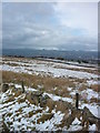
Across Burnley to Pendle
Taken on Crown Point Road, Burnley, at the junction of Woodplumpton Road.
Image: © Carroll Pierce
Taken: 17 Mar 2013
0.16 miles
9
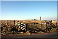
Crown Point Road
Part of The Burnley Way footpath looking towards Crown Point House
Image: © Kevin Rushton
Taken: 16 Feb 2008
0.17 miles
10

Cattle grid on Crown Point Road
This is where the Burnley Way crosses the road.
Image: © Bill Boaden
Taken: 2 Jan 2011
0.17 miles