IMAGES TAKEN NEAR TO
St. Stephen Street, BURNLEY, BB11 3JA
Introduction
This page details the photographs taken nearby to St. Stephen Street, BB11 3JA by members of the Geograph project.
The Geograph project started in 2005 with the aim of publishing, organising and preserving representative images for every square kilometre of Great Britain, Ireland and the Isle of Man.

There are currently over 7.5m images from over14,400 individuals and you can help contribute to the project by visiting https://www.geograph.org.uk
Image Map
Images are licensed for reuse under creativecommons.org/licenses/by-sa/2.0
Notes
- Clicking on the map will re-center to the selected point.
- The higher the marker number, the further away the image location is from the centre of the postcode.
Image Listing (105 Images Found)
Images are licensed for reuse under creativecommons.org/licenses/by-sa/2.0
Image
Details
Distance
1
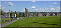
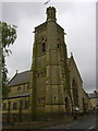
St. Stephen's Church, Oxford Road, Burnley
Here's a view made possible by the demolition of hundreds of houses
Image: © Robert Wade
Taken: 17 Jun 2010
0.00 miles
2
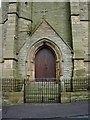
The Parish Church of St Stephen, Burnley, Doorway
Image: © Alexander P Kapp
Taken: 4 Apr 2008
0.00 miles
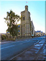
3
St. Stephen's Church, Oxford Road, Burnley Wood
Image: © Robert Wade
Taken: 19 May 2011
0.01 miles
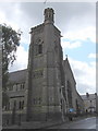
4
The Parish Church of St Stephen, Burnley
Image: © Alexander P Kapp
Taken: 4 Apr 2008
0.01 miles
5

The Parish Church of St Stephen, Burnley
Image: © Alexander P Kapp
Taken: 4 Apr 2008
0.01 miles
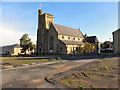
6
St. Stephen's Church, Oxford Road, Burnley
Image: © Robert Wade
Taken: 22 May 2009
0.02 miles
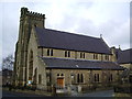
7
Parish Church Of St Stephen
Oxford Road, Burnley
Image: © David Dixon
Taken: 7 Oct 2010
0.03 miles
8
St Stephen's Parish Church
Oxford Road, Burnley.
Image: © David Dixon
Taken: 7 Oct 2010
0.03 miles
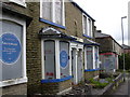
10
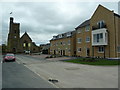
New housing near St Stephen's Church, Burnley Wood
Image: © Alexander P Kapp
Taken: 4 Oct 2011
0.03 miles