IMAGES TAKEN NEAR TO
Lindsay Street, BURNLEY, BB11 2SF
Introduction
This page details the photographs taken nearby to Lindsay Street, BB11 2SF by members of the Geograph project.
The Geograph project started in 2005 with the aim of publishing, organising and preserving representative images for every square kilometre of Great Britain, Ireland and the Isle of Man.

There are currently over 7.5m images from over14,400 individuals and you can help contribute to the project by visiting https://www.geograph.org.uk
Image Map
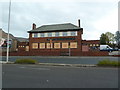
Images are licensed for reuse under creativecommons.org/licenses/by-sa/2.0
Notes
- Clicking on the map will re-center to the selected point.
- The higher the marker number, the further away the image location is from the centre of the postcode.
Image Listing (205 Images Found)
Images are licensed for reuse under creativecommons.org/licenses/by-sa/2.0
Image
Details
Distance
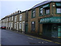
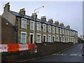
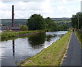
4
Houses next to the Leeds and Liverpool Canal in Burnley
Image: © Mat Fascione
Taken: 27 Jun 2016
0.03 miles

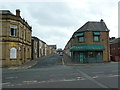
8
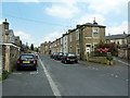
It's called a square but it is a triangle
Brown Square, Burnley
Image: © Alexander P Kapp
Taken: 28 May 2012
0.05 miles
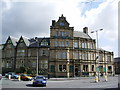
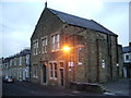
10
White Hart, Church Street, Burnley
Image: © Alexander P Kapp
Taken: 9 Nov 2011
0.06 miles