IMAGES TAKEN NEAR TO
Hall Park Avenue, BURNLEY, BB10 4JJ
Introduction
This page details the photographs taken nearby to Hall Park Avenue, BB10 4JJ by members of the Geograph project.
The Geograph project started in 2005 with the aim of publishing, organising and preserving representative images for every square kilometre of Great Britain, Ireland and the Isle of Man.

There are currently over 7.5m images from over14,400 individuals and you can help contribute to the project by visiting https://www.geograph.org.uk
Image Map
Images are licensed for reuse under creativecommons.org/licenses/by-sa/2.0
Notes
- Clicking on the map will re-center to the selected point.
- The higher the marker number, the further away the image location is from the centre of the postcode.
Image Listing (19 Images Found)
Images are licensed for reuse under creativecommons.org/licenses/by-sa/2.0
Image
Details
Distance
2
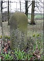
Boundary stone, Red Lees Road, Burnley
Marking the boundary between Burnley and Cliviger, but why Brunshaw? Frederic A Youngs gives the answer in his monumental 'Guide to the Local Administrative Units of England'. It was a civil parish created in 1894 from the part of Burnley civil parish not in Burnley County Borough. Abolished 1911, part to Burnley County Borough and part to Cliviger CP. Its short life missed most OS maps, but it is shown on the one-inch map of 1895, Sheet 76, Rossendale. This has been reprinted by Alan Godfrey Maps. Brunshaw had a tiny area, not really viable as a civil parish, between Towneley Hall Park and Red Lees Road.
Image: © Humphrey Bolton
Taken: 27 Feb 2011
0.14 miles
5
Red Lees Road, Cliviger
That is the Parish of Cliviger, there is no place called that.
Image: © Alexander P Kapp
Taken: 7 Jan 2010
0.16 miles
7
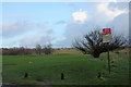
Deerpark Road
Brunshaw 9 hole golf, the course is on both sides of Deerpark Road
Image: © Kevin Rushton
Taken: 4 Feb 2008
0.16 miles
8

Bus stop and shelter on Red Lees Road
National Cycle Route 68.
Image: © JThomas
Taken: 16 Jul 2016
0.16 miles