
IMAGES TAKEN NEAR TO
Hurstwood Village, BURNLEY, BB10 3LJ
Introduction
This page details the photographs taken nearby to Hurstwood Village, BB10 3LJ by members of the Geograph project.
The Geograph project started in 2005 with the aim of publishing, organising and preserving representative images for every square kilometre of Great Britain, Ireland and the Isle of Man.

There are currently over 7.5m images from over14,400 individuals and you can help contribute to the project by visiting https://www.geograph.org.uk
Image Map
Images are licensed for reuse under creativecommons.org/licenses/by-sa/2.0
Notes
- Clicking on the map will re-center to the selected point.
- The higher the marker number, the further away the image location is from the centre of the postcode.
Image Listing (30 Images Found)
Images are licensed for reuse under creativecommons.org/licenses/by-sa/2.0
Image
Details
Distance
1
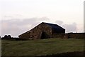
Cant Clough Farm
The farm has recently been re furbished
Image: © Kevin Rushton
Taken: 3 Jan 2008
0.02 miles
2
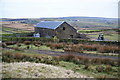
Cant Clough Farm
This appears to be just a barn now.
Image: © Bill Boaden
Taken: 30 Dec 2010
0.02 miles
3
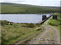
The Pennine Bridleway Mary Towneley loop near Cant Clough Reservoir
Image: © Dave Kelly
Taken: 4 Jul 2019
0.04 miles
4
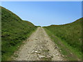
Pennine Bridleway ascending away from Cant Clough Reservoir
Heading north towards Hurstwood Reservoir
Image: © Chris Heaton
Taken: 5 Jul 2013
0.05 miles
5
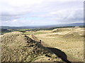
Hindle Banks
Track from Cant Clough to Hurstwood Reservoir
Image: © Kevin Rushton
Taken: 31 Dec 2001
0.05 miles
6
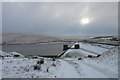
Cant Clough Reservoir
Track from Hurstwood Reservoir.
Image: © Kevin Rushton
Taken: 2 Feb 2009
0.05 miles
8
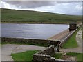
Cant Clough Reservoir: the north-west corner
Image: © John H Darch
Taken: 9 Aug 2013
0.07 miles
9
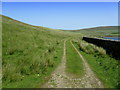
Track beside Cant Clough Reservoir
Track on the northern edge of the reservoir.
Image: © Chris Heaton
Taken: 5 Jul 2013
0.09 miles
10
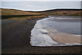
The north shore of Cant Clough Reservoir
Still frozen although all the snow has melted.
Image: © Bill Boaden
Taken: 30 Dec 2010
0.09 miles