
IMAGES TAKEN NEAR TO
Rowan Grove, BURNLEY, BB10 3FE
Introduction
This page details the photographs taken nearby to Rowan Grove, BB10 3FE by members of the Geograph project.
The Geograph project started in 2005 with the aim of publishing, organising and preserving representative images for every square kilometre of Great Britain, Ireland and the Isle of Man.

There are currently over 7.5m images from over14,400 individuals and you can help contribute to the project by visiting https://www.geograph.org.uk
Image Map
Images are licensed for reuse under creativecommons.org/licenses/by-sa/2.0
Notes
- Clicking on the map will re-center to the selected point.
- The higher the marker number, the further away the image location is from the centre of the postcode.
Image Listing (10 Images Found)
Images are licensed for reuse under creativecommons.org/licenses/by-sa/2.0
Image
Details
Distance
1
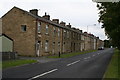
Ridge Row, Burnley Ridge, Lancashire
This fine terrace of stone houses was here well before other housing which is close by. There are 20 houses here, numbered consecutively from 1 (at this end) to 20 (which is a small general shop). Rightly valued by their owners, almost all have been modernised with double glazing. They have excellent views from the back, extending over the Brun valley eastwards into Yorkshire.
Image: © Dr Neil Clifton
Taken: 8 Sep 2007
0.16 miles
2
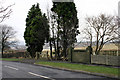
Ridge Avenue
The wall to the middle is actually an old bridge, it was part of a tramway system linking the coal mine at Rowley with the other mines in the area
Image: © Kevin Rushton
Taken: 31 Jan 2008
0.17 miles
3
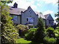
Edwardian Houses, Queen's Park Road, Burnley
Image: © Robert Wade
Taken: 17 Jun 2010
0.18 miles
4
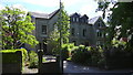
Victorian Houses, Queen's Park Road, Burnley
Image: © Robert Wade
Taken: 17 Jun 2010
0.19 miles
5
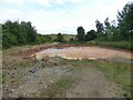
Settling Pond
Adjacent to the reclaimed land known as Jubilee Meadow. The land was previously a land fill site on the original course of the River Brun which has been diverted closer to Rowley Hall. The recovered land has also included the site of Rowley Colliery and this pond may have mine water.
Image: © Kevin Waterhouse
Taken: 20 Jul 2024
0.19 miles
6
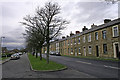
Ridge Row
Terraced houses facing Turf Moor Estate
Image: © Kevin Rushton
Taken: 31 Jan 2008
0.21 miles
7
Footpath at the rear of Browsholme Avenue, Burnley
Image: © Alexander P Kapp
Taken: 14 Apr 2008
0.21 miles
8
Footpath along the front of Nos81 to 93 Holcombe Drive
Image: © Alexander P Kapp
Taken: 14 Apr 2008
0.21 miles
9
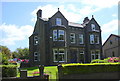
Pair of Victorian Houses, Queen's Park Road, Burnley
Image: © Robert Wade
Taken: 17 Jun 2010
0.22 miles
10
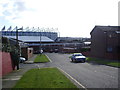
Holcombe Drive, Burnley
With Turf Moor football ground in the distance
Image: © Alexander P Kapp
Taken: 14 Apr 2008
0.23 miles