IMAGES TAKEN NEAR TO
Hallwood Close, BURNLEY, BB10 2LQ
Introduction
This page details the photographs taken nearby to Hallwood Close, BB10 2LQ by members of the Geograph project.
The Geograph project started in 2005 with the aim of publishing, organising and preserving representative images for every square kilometre of Great Britain, Ireland and the Isle of Man.

There are currently over 7.5m images from over14,400 individuals and you can help contribute to the project by visiting https://www.geograph.org.uk
Image Map (26 Images)


Leaflet Map data © OpenStreetMap
Images are licensed for reuse under creativecommons.org/licenses/by-sa/2.0
Notes
- Clicking on the map will re-center to the selected point.
- The higher the marker number, the further away the image location is from the centre of the postcode.
Image Listing (26 Images Found)
Images are licensed for reuse under creativecommons.org/licenses/by-sa/2.0
Image
Details
Distance
2
Elizabeth II postbox on Colne Road
Postbox No. BB11 28.
See Image] for close up.
Image: © JThomas
Taken: 16 Jul 2016
0.09 miles
3
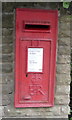
Close up, Elizabeth II postbox on Colne Road
Postbox No. BB11 28.
See Image] for wider view.
Image: © JThomas
Taken: 16 Jul 2016
0.09 miles
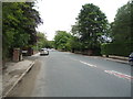
5
Ordnance Survey Cut Mark
This mark can be found on the wall at the junction of Robinson Lane and Colne Road.
For more detail see : http://www.bench-marks.org.uk/bm30499
Image: © Peter Wood
Taken: 5 Sep 2012
0.10 miles
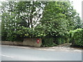
6
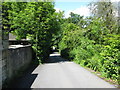
Robinson Lane, Reedley: looking west
This narrow lane connects the A682 to some nursery gardens and Monkhey Farm. There is no through road for motor traffic.
Image: © Dr Neil Clifton
Taken: 16 Jun 2009
0.11 miles
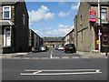
7

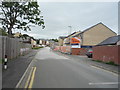
Houses on Reedley Road
A row of terraced houses on Reedley Road, just before its meets the A682.
Image: © Chris Heaton
Taken: 18 Jan 2011
0.11 miles
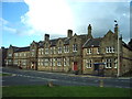
9
Lord Street, Brierfield, Lancashire
Image: © Dr Neil Clifton
Taken: 16 Jun 2009
0.14 miles
10
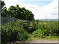
Public footpath off Robinson Lane, Reedley
This footpath runs southwards alongside the railway from Robinson Lane for almost half a mile, where a choice can then be made between turning left over a footbridge to cross the railway and regain the A682, or to turn right and after about a quarter mile, cross the canal by a footbridge (Bridge 135) and eventually emerge on Barden Lane.
Image: © Dr Neil Clifton
Taken: 16 Jun 2009
0.14 miles