IMAGES TAKEN NEAR TO
Netherwood Road, BURNLEY, BB10 2AH
Introduction
This page details the photographs taken nearby to Netherwood Road, BB10 2AH by members of the Geograph project.
The Geograph project started in 2005 with the aim of publishing, organising and preserving representative images for every square kilometre of Great Britain, Ireland and the Isle of Man.

There are currently over 7.5m images from over14,400 individuals and you can help contribute to the project by visiting https://www.geograph.org.uk
Image Map
Images are licensed for reuse under creativecommons.org/licenses/by-sa/2.0
Notes
- Clicking on the map will re-center to the selected point.
- The higher the marker number, the further away the image location is from the centre of the postcode.
Image Listing (23 Images Found)
Images are licensed for reuse under creativecommons.org/licenses/by-sa/2.0
Image
Details
Distance
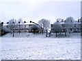
1
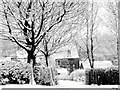
Heasandford House
Heasandford House viewed from Queen Victoria road. The house belonged to Oliver de Stansfield in 1310.
Image: © Kevin Rushton
Taken: 29 Dec 2004
0.01 miles
2
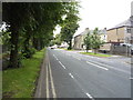
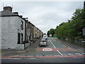
Eastern Avenue, Burnley
Heading south west.
Image: © JThomas
Taken: 16 Jul 2016
0.06 miles
3
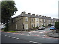
Houses on Melville Street
Off Eastern Avenue.
Image: © JThomas
Taken: 16 Jul 2016
0.06 miles
4
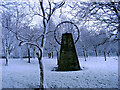
Bank Hall Park
Parkland made on former colliery, the pit opened 6th April 1865 and closed June 1971
Image: © Kevin Rushton
Taken: 8 Jan 2005
0.09 miles
5
Basnett Street
Looking north from Eastern Avenue.
Image: © JThomas
Taken: 16 Jul 2016
0.10 miles
6
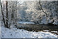
River Brun
Looking up river from under Heasandford Bridge
Image: © Kevin Rushton
Taken: 5 Mar 2006
0.12 miles
7
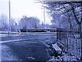
Eastern Avenue and Queen Victoria Road
View from the entrance to Bank Hall Park towards Heasandford
Image: © Kevin Rushton
Taken: 8 Jan 2005
0.12 miles
8
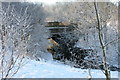
Bank Hall Park
Heasandford Bridge over the River Brun
Image: © Kevin Rushton
Taken: 5 Mar 2006
0.13 miles
10
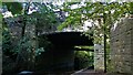
River Brun Path under Heasandford Bridge
Part of the Bronte Way
Image: © Kevin Waterhouse
Taken: 5 Oct 2020
0.14 miles