IMAGES TAKEN NEAR TO
Queens Road, BURNLEY, BB10 1XX
Introduction
This page details the photographs taken nearby to Queens Road, BB10 1XX by members of the Geograph project.
The Geograph project started in 2005 with the aim of publishing, organising and preserving representative images for every square kilometre of Great Britain, Ireland and the Isle of Man.

There are currently over 7.5m images from over14,400 individuals and you can help contribute to the project by visiting https://www.geograph.org.uk
Image Map
Images are licensed for reuse under creativecommons.org/licenses/by-sa/2.0
Notes
- Clicking on the map will re-center to the selected point.
- The higher the marker number, the further away the image location is from the centre of the postcode.
Image Listing (31 Images Found)
Images are licensed for reuse under creativecommons.org/licenses/by-sa/2.0
Image
Details
Distance
1
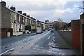
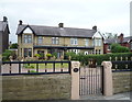
Peart Street, Burnley
A traditional residential street with Burnley General Hospital at the far end.
Image: © Bill Boaden
Taken: 18 Nov 2015
0.06 miles
2
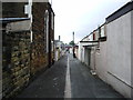
Back alley near Burnley General Hospital
Image: © Alexander P Kapp
Taken: 30 May 2007
0.07 miles
5
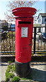
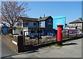
Elizabeth II postbox on Colne Road, Burnley
Postbox No. BB10 89.
See Image] for context.
Image: © JThomas
Taken: 19 Apr 2019
0.10 miles
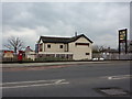
7
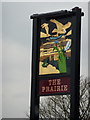
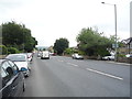
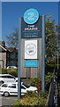
The Prairie public house, Burnley
On Colne Road.
Showing position of Postbox No. BB10 89.
See Image] for postbox
Image: © JThomas
Taken: 19 Apr 2019
0.11 miles