
IMAGES TAKEN NEAR TO
North Cheriton, TEMPLECOMBE, BA8 0AQ
Introduction
This page details the photographs taken nearby to BA8 0AQ by members of the Geograph project.
The Geograph project started in 2005 with the aim of publishing, organising and preserving representative images for every square kilometre of Great Britain, Ireland and the Isle of Man.

There are currently over 7.5m images from over14,400 individuals and you can help contribute to the project by visiting https://www.geograph.org.uk
Image Map
Images are licensed for reuse under creativecommons.org/licenses/by-sa/2.0
Notes
- Clicking on the map will re-center to the selected point.
- The higher the marker number, the further away the image location is from the centre of the postcode.
Image Listing (22 Images Found)
Images are licensed for reuse under creativecommons.org/licenses/by-sa/2.0
Image
Details
Distance
1
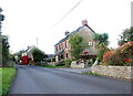
Houses in North Cheriton
North Cheriton is a small scattered village just off the A357 Stalbridge to Wincanton Rd. These houses are on Hardings Lane
Image: © Nigel Mykura
Taken: 16 Oct 2021
0.01 miles

3

The Old Red Lion
Former public house, on Hardings Lane.
Image: © Roger Cornfoot
Taken: 22 Mar 2021
0.07 miles
4

Old Direction Sign - Signpost by the A357, North Cheriton
Pyramid finial - 2 arms; Somerset SCC pyramid by the A357, in parish of North Cheriton (South Somerset District), junction with lane to Holton.
Surveyed
Milestone Society National ID: SO_ST6925A
Image: © Milestone Society
Taken: Unknown
0.09 miles
6
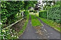
North Cheriton: Elm Cottage, Hardings Lane
Image: © Michael Garlick
Taken: 17 Jun 2019
0.11 miles
7
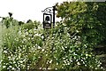
North Cheriton: Elm Cottage sign, Hardings Lane
Image: © Michael Garlick
Taken: 17 Jun 2019
0.14 miles
9

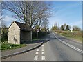
North Cheriton: Shelter, corner of Hardings Lane and Blackacre Hill
Image: © Michael Garlick
Taken: 17 Jun 2019
0.15 miles
10

Old Direction Sign - Signpost by the A357, North Cheriton parish
Pyramid finial - 1 arm; Somerset SCC pyramid by the A357, in parish of North Cheriton (South Somerset District), junction with lane to village at Blackacre Hill.
Surveyed
Milestone Society National ID: SO_ST6925B
Image: © Milestone Society
Taken: Unknown
0.15 miles