
IMAGES TAKEN NEAR TO
Feversham Lane, GLASTONBURY, BA6 9FH
Introduction
This page details the photographs taken nearby to Feversham Lane, BA6 9FH by members of the Geograph project.
The Geograph project started in 2005 with the aim of publishing, organising and preserving representative images for every square kilometre of Great Britain, Ireland and the Isle of Man.

There are currently over 7.5m images from over14,400 individuals and you can help contribute to the project by visiting https://www.geograph.org.uk
Image Map
Images are licensed for reuse under creativecommons.org/licenses/by-sa/2.0
Notes
- Clicking on the map will re-center to the selected point.
- The higher the marker number, the further away the image location is from the centre of the postcode.
Image Listing (589 Images Found)
Images are licensed for reuse under creativecommons.org/licenses/by-sa/2.0
Image
Details
Distance
1
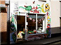
Crazy fruit
A fruit and veg shop in Benedict Street, with some unconventional graphics to draw in the punters. Maybe there are some more exotic comestibles on sale within?
Image: © Neil Owen
Taken: 18 Sep 2012
0.01 miles
2

Sign for the Mitre
A reference to the deeply cleft hat, having the shape of a pointed arch at the front and back, worn by bishops and some abbots. A symbol of the bishop's office. It makes a convenient visual symbol and has been used as an inn sign since the 15th century, especially in cathedral cities.
Image: © Maigheach-gheal
Taken: 20 Sep 2009
0.01 miles
3
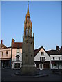
Glastonbury Market Cross
A view looking east towards the Market Cross at Glastonbury. The present structure was built in 1846 to replace an earlier mediaeval cross removed in 1806, and was refurbished in 2005 as part of the 300th anniversary of the town.
Image: © Phil Williams
Taken: 1 Apr 2007
0.01 miles
4
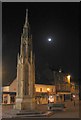
Glastonbury Market Cross by night
A view looking to the east towards the Market Cross.
Image: © Phil Williams
Taken: 1 Apr 2007
0.01 miles
5
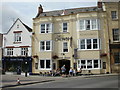
The Crown, Glastonbury
Located at 4 Market Place, opposite the market cross. http://www.geograph.org.uk/photo/183446
The Crown was a coaching inn, dating from the 16th century. In modern terms, a pub with accommodation. Attractions advertised on the front of the premises include cask ales, live entertainment, coffee, Internet cafe, pool (I think that's the game rather than a place for a dip) and large-screen TV.
Image: © Jaggery
Taken: 7 Jul 2010
0.01 miles
6

King William, Glastonbury
Pub at the southern end of Northload Street.
The pub sign doesn't portray a former British King William. The character shown is suspiciously like Richmal Crompton's Just William - a young schoolboy with an untidy collar and tie, wearing a paper crown.
Image: © Jaggery
Taken: 7 Jul 2010
0.01 miles
7
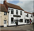
Hawthorns, Glastonbury
Bar and restaurant, with accommodation available. Located on Northload Street, near St John's Square.
Image: © Jaggery
Taken: 7 Jul 2010
0.01 miles
8
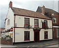
The Who'd A Thought It Inn, Glastonbury
Located on Northload Street, opposite St John's Square.
The inn sign indicates that real ale, fine food and en-suite accommodation is available. Despite the name of the inn, anyone hoping that the giant ice cream cone (next to the No Entry sign) is the same size as the one they'll get is likely to be disappointed...
Image: © Jaggery
Taken: 7 Jul 2010
0.01 miles
9
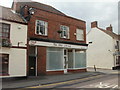
Turning Point, The Old Library, Glastonbury
19 Northload Street. The new library is in Orchard Court. http://www.geograph.org.uk/photo/1997185
Turning Point is a social care organisation. They provide services for people with complex needs, including those affected by drug and alcohol misuse, mental health problems and those with a learning disability.
Image: © Jaggery
Taken: 7 Jul 2010
0.01 miles
10
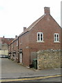
Crown Barton, Glastonbury
Located on the SW side of St John's Square.
Image: © Jaggery
Taken: 7 Jul 2010
0.01 miles