
IMAGES TAKEN NEAR TO
Chilkwell Street, GLASTONBURY, BA6 8DQ
Introduction
This page details the photographs taken nearby to Chilkwell Street, BA6 8DQ by members of the Geograph project.
The Geograph project started in 2005 with the aim of publishing, organising and preserving representative images for every square kilometre of Great Britain, Ireland and the Isle of Man.

There are currently over 7.5m images from over14,400 individuals and you can help contribute to the project by visiting https://www.geograph.org.uk
Image Map
Images are licensed for reuse under creativecommons.org/licenses/by-sa/2.0
Notes
- Clicking on the map will re-center to the selected point.
- The higher the marker number, the further away the image location is from the centre of the postcode.
Image Listing (238 Images Found)
Images are licensed for reuse under creativecommons.org/licenses/by-sa/2.0
Image
Details
Distance
1
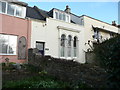
No 13B Chilkwell Street, Glastonbury
The details in the National Heritage Listing state that this is a late 19C extension to the early 19C stucco house to the right. This extension has a large Venetian-style window of three round-headed lights and twisted mullions. The extension has been made into a cottage, and the window dwarfs the doorway, which is within the further extension of the row to the left.
Image: © Humphrey Bolton
Taken: 3 Mar 2012
0.01 miles
2

Tibetan prayer wheels
All religions, cults, beliefs and alternative cultures are catered for in Glastonbury. The place would welcome everyone from the Dalai Lama to Bilbo Baggins.
Image: © william
Taken: 10 Apr 2009
0.06 miles
3

Postbox near the roundabout
The third regents postbox I have come across on my walk to this part of Glastonbury.
Image: © Bill Nicholls
Taken: 5 Mar 2011
0.07 miles
4
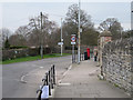
Postbox on Chilkwell Street
View along the pavement towards the postbox which is on Chilkwell Street in Glastonbury.
Image: © Bill Nicholls
Taken: 5 Mar 2011
0.07 miles
5
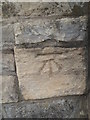
Benchmark on Chilkwell Street, Glastonbury
This cut mark is on the east side of Chilkwell Street in Glastonbury. For more details see: http://www.bench-marks.org.uk/bm37223
Image: © Meirion
Taken: 12 Sep 2016
0.08 miles
6
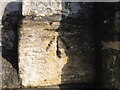
An old benchmark on Chilkwell Street
This cutmark is a nineteenth century creation on the road surrounding the Tor. Oddly it is not listed officially but is in the Benchmark Database: https://www.bench-marks.org.uk/bm37223 . See Image for a wider view.
Image: © Neil Owen
Taken: 20 Dec 2022
0.08 miles
7
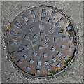
Manhole cover, Glastonbury
Manhole cover on Dod Lane in Glastonbury. It was cast in the Exeter foundry of Garton & King, a company which can be traced back to 1661 - see http://www.exeterfoundry.org.uk/index.php for further information.
Image: © Rossographer
Taken: 6 Aug 2013
0.08 miles
8
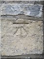
Chilkwell Street Benchmark
I walked from the caravan site to find this and it took me ages as I had only spotted it from the car while my wife was driving past. I'd thought it was on the gatepost, it's on the wall to the right. Image
Image: © Bill Nicholls
Taken: 5 Mar 2011
0.08 miles
9
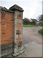
The second Gatepost
The second gatepost which I thought held the benchmark but it does have an old SV plate on it.
Image: © Bill Nicholls
Taken: 5 Mar 2011
0.08 miles
10
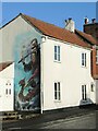
A viking mural in Glastonbury
Some legendary imagery on a private house.
Image: © Neil Owen
Taken: 20 Dec 2022
0.08 miles