IMAGES TAKEN NEAR TO
Croscombe, WELLS, BA5 3RE
Introduction
This page details the photographs taken nearby to BA5 3RE by members of the Geograph project.
The Geograph project started in 2005 with the aim of publishing, organising and preserving representative images for every square kilometre of Great Britain, Ireland and the Isle of Man.

There are currently over 7.5m images from over14,400 individuals and you can help contribute to the project by visiting https://www.geograph.org.uk
Image Map
Images are licensed for reuse under creativecommons.org/licenses/by-sa/2.0
Notes
- Clicking on the map will re-center to the selected point.
- The higher the marker number, the further away the image location is from the centre of the postcode.
Image Listing (90 Images Found)
Images are licensed for reuse under creativecommons.org/licenses/by-sa/2.0
Image
Details
Distance
1
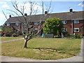
Somerville Cottages
A tree seems to have not survived the winter, sadly. It was a nice feature of the small open area in front of the homes.
Image: © Neil Owen
Taken: 1 Jun 2020
0.01 miles
2
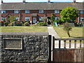
Somerville Cottages
A small post-war development on Fayre Way is helpfully noted and dated. Incidentally, Fayre Way was once known as Back Lane in previous centuries.
Image: © Neil Owen
Taken: 1 Jun 2020
0.01 miles
3
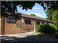
Croscombe village hall
Croscombe finally had its wish for a hall, built in 1983.
Image: © Neil Owen
Taken: 1 Jun 2020
0.02 miles
4
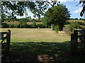
Croscombe playing field
Next to the hall is the playing fields and children's play area.
Image: © Neil Owen
Taken: 1 Jun 2020
0.07 miles
5
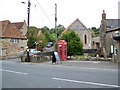
Telephone box, Croscombe
K6 style telephone box beside the A371.
Image: © Maigheach-gheal
Taken: 18 Sep 2009
0.10 miles
7
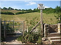
Footpaths by West Lane
Heading north from Croscombe are two footpaths, one of which heads west towards Dinder Wood. You can chose which method of entry.
Image: © Neil Owen
Taken: 1 Jun 2020
0.10 miles
8

Old Milestone on the A371 Long Street, Croscombe
Metal plate set in brick by the A371, in parish of Croscombe (Mendip District), Long Street, in village of Croscombe, plate fixed to front garden wall, on South side of road. Wells iron plate erected by the Wells turnpike trust in the 19th century.
Inscription reads:- WELLS / III
Milestone Society National ID: SO_SMWL02
Image: © Mike Faherty
Taken: 12 Apr 2009
0.10 miles
9

Croscombe: Ashley House
With a sundial above the entrance. On the road from Shepton Mallet to Wells
Image: © Martin Bodman
Taken: 21 Sep 2008
0.10 miles