IMAGES TAKEN NEAR TO
Rookham Hill, WELLS, BA5 3AL

Introduction

This page details the photographs taken nearby to Rookham Hill, BA5 3AL by members of the Geograph project.

The Geograph project started in 2005 with the aim of publishing, organising and preserving representative images for every square kilometre of Great Britain, Ireland and the Isle of Man.

There are currently over 7.5m images from over14,400 individuals and you can help contribute to the project by visiting https://www.geograph.org.uk

Image Map


Images are licensed for reuse under creativecommons.org/licenses/by-sa/2.0
Notes
  • Clicking on the map will re-center to the selected point.
  • The higher the marker number, the further away the image location is from the centre of the postcode.

Image Listing (16 Images Found)

Images are licensed for reuse under creativecommons.org/licenses/by-sa/2.0
Image
Details
Distance
1
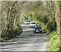
2009 : Old Bristol Road
Heading north through Rookham Wood. Once the main highway between Wells and Bristol now reduced to a minor road. Not even a 'B' classification. Nothing lasts for ever.
Image: © Maurice Pullin Taken: 29 Mar 2009
0.04 miles
2
Track meeting Old Bristol Road
Footpath WS 10/19 follows this track to the junction with Old Bristol Road, just past the tall oak.
Image: © Derek Harper Taken: 17 Jun 2010
0.05 miles
3
Pumping station by Holes Ash Spring
Keeping the flow down the Mendips under control.
Image: © Neil Owen Taken: 25 Mar 2021
0.06 miles
4
Looking west from Old Bristol Road
Once over the stile, a footpath runs down the hillside to emerge on Tynings Lane.
Image: © John Baker Taken: 2 Apr 2016
0.06 miles
5
2009 : Pasture east of the Old Bristol Road
Looking south east near Rookham.
Image: © Maurice Pullin Taken: 29 Mar 2009
0.09 miles
6
2009 : The Old Bristol Road
About one and a half miles out of Wells and about half way up the south Mendip escarpment the old coach road makes its way toward Bristol (those poor horses). About seven miles further on it passes between Compton Martin and West Harptree then plunges into the Chew Valley Lake (those poor horses!)
Image: © Maurice Pullin Taken: 29 Mar 2009
0.11 miles
7
Field by Welsh's Green Lane
A view from bridleway WS 10/19 across a field towards the Old Bristol Road, with a view across the Somerset Levels in the background.
Image: © Derek Harper Taken: 17 Jun 2010
0.12 miles
8
2009 : Mendip hill, on the Old Bristol Road
The southern Mendip escarpment with a view of Glastonbury Tor Image
Image: © Maurice Pullin Taken: 29 Mar 2009
0.12 miles
9
Bracketry on the Old Bristol Road
A dead tree is being consumed by bracket fungus. They grow in a way that looks like contour lines or rock strata.
Image: © Neil Owen Taken: 25 Mar 2021
0.15 miles
10
Field beside Old Bristol Road
Taken from the other side of the road glimpsed in Image Two oaks stand in the middle of the field, which is on the slopes of the Mendip Hills,and is crossed by footpath WS 10/17B. Ahead are Milton Hill and Arthur's Point.
Image: © Derek Harper Taken: 17 Jun 2010
0.15 miles