
IMAGES TAKEN NEAR TO
Swanshard Lane, WELLS, BA5 1NW
Introduction
This page details the photographs taken nearby to Swanshard Lane, BA5 1NW by members of the Geograph project.
The Geograph project started in 2005 with the aim of publishing, organising and preserving representative images for every square kilometre of Great Britain, Ireland and the Isle of Man.

There are currently over 7.5m images from over14,400 individuals and you can help contribute to the project by visiting https://www.geograph.org.uk
Image Map
Images are licensed for reuse under creativecommons.org/licenses/by-sa/2.0
Notes
- Clicking on the map will re-center to the selected point.
- The higher the marker number, the further away the image location is from the centre of the postcode.
Image Listing (18 Images Found)
Images are licensed for reuse under creativecommons.org/licenses/by-sa/2.0
Image
Details
Distance
1

Old Direction Sign - Signpost in Fenny Castle, Wookey Parish
Pyramid finial - 3 arms; Somerset SCC pyramid by the UC road, in parish of Wookey (Mendip District), Fenny Castle, junction of Castle Lane with Ashmoor Drove, and opposite Swanshard Lane.
Surveyed
Milestone Society National ID: SO_ST5043.
Image: © Milestone Society
Taken: Unknown
0.02 miles
2

Communications by Castle Lane
Some useful parish information and a pillar box at the farm entrance. There can't be many people living locally, though.
Image: © Neil Owen
Taken: 21 Oct 2021
0.02 miles
3
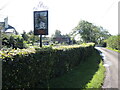
Sign for Fenny Castle
It appears to be an unofficial sign on private property, but a nice one nonetheless.
Image: © Neil Owen
Taken: 21 Oct 2021
0.03 miles
4
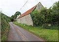
Castle Lane
Passing Patience Farm, with a fine stone and tile barn alongside the road.
Image: © Derek Harper
Taken: 15 Aug 2011
0.04 miles
5
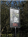
Woven into the willow
A sign for Fenny Castle echoes the local marshland vegetation.
Image: © Neil Owen
Taken: 21 Oct 2021
0.05 miles
6
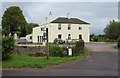
Fenny Castle House
The motte and bailey castle shown in Image is a little to the south of this building which offers bed and breakfast and bike hire. Access is across the River Sheppey in the foreground.
Image: © Derek Harper
Taken: 15 Aug 2011
0.05 miles
7
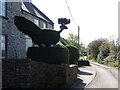
Clipped of Castle Farm
Some fine and probably patiently crafted topiary.
Image: © Neil Owen
Taken: 21 Oct 2021
0.06 miles
8
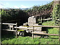
Fenny Castle cross
Although the cross is no longer in complete form, the plinth and some parts of the upper section are evident. The cross is believed to be a fourteenth century roadside example and one of few left in the country. Nearby was a well, which may be associated with the cross. Grade II listed monument.
Image: © Neil Owen
Taken: 21 Oct 2021
0.07 miles
9
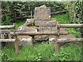
Remains of cross, Castle
The base of a medieval (C14) wayside cross beside Castle Lane. "Traditionally it is associated with a nearby well, and the remains of the wellhead may be seen in the undergrowth. It appears to be a water cross which are rare in Somerset" http://webapp1.somerset.gov.uk/her/details.asp?prn=24232 . The briefer listed building description is at http://www.britishlistedbuildings.co.uk/en-268172-roadside-cross-at-ngr-st-5084-4407-wooke .
Image: © Derek Harper
Taken: 15 Aug 2011
0.07 miles
10
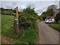
Public footpath leading from Castle Lane
Image: © Rob Purvis
Taken: 19 May 2016
0.08 miles