
IMAGES TAKEN NEAR TO
Station Road, WELLS, BA5 1EY
Introduction
This page details the photographs taken nearby to Station Road, BA5 1EY by members of the Geograph project.
The Geograph project started in 2005 with the aim of publishing, organising and preserving representative images for every square kilometre of Great Britain, Ireland and the Isle of Man.

There are currently over 7.5m images from over14,400 individuals and you can help contribute to the project by visiting https://www.geograph.org.uk
Image Map
Images are licensed for reuse under creativecommons.org/licenses/by-sa/2.0
Notes
- Clicking on the map will re-center to the selected point.
- The higher the marker number, the further away the image location is from the centre of the postcode.
Image Listing (53 Images Found)
Images are licensed for reuse under creativecommons.org/licenses/by-sa/2.0
Image
Details
Distance
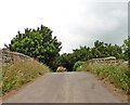
2
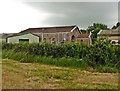
Goods shed at former Westbury-Sub-Mendip railway station
Now incorporated as part of a modern industrial estate.
Image: © Roger Cornfoot
Taken: 13 Jun 2018
0.04 miles
3
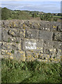
Station road railway bridge benchmark
Just south of Westbury-sub-Mendip is a railway bridge that used to be right beside the old station. The line closed many years ago and the station is now a small business park, but the bridge that carries Station Road remains. A benchmark can be seen in the whitened area in the middle. See Image] for a wider view and http://www.bench-marks.org.uk/bm79252 for the entry in the Benchmark Database.
Image: © Neil Owen
Taken: 23 Sep 2016
0.04 miles
4
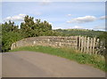
Station Road, but with no station
Westbury-sub-Mendip's railway station opened in April 1870 as part of the Bristol and Exeter Railway's Cheddar Valley line. It was originally a broad gauge line but soon converted to narrow. The line was known as the Strawberry Line, due to the large amount of the popular fruit that was (and continues to be) grown here.
Westbury's station was actually referred to as Lodge Hill (a local hill just south of the line) so as not to confuse it with others of the same name. The line closed completely in 1969.
See Image] for a benchmark in the middle of the bridge.
Image: © Neil Owen
Taken: 23 Sep 2016
0.04 miles
5
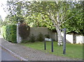
Lodge Hill path
A footpath in among the suburban houses, leading only to a short walk around the road.
Image: © Neil Owen
Taken: 23 Sep 2016
0.05 miles
6
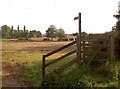
Follow your nose
And the path will take you to a sewage works, among other delights.
Nailed onto the wooden post is another, smaller, sign from Somerset County Council. It warns that, under the Highways Act, 1980, S.131, (2,3), it is an offence to remove this signpost - subject to a maximum fine of £1000. The farm gate beside the kissing gate is open, just to make it even more unnecessary.
Image: © Neil Owen
Taken: 23 Sep 2016
0.06 miles
7
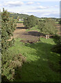
The Strawberries go by motor nowadays
Looking east from the bridge over Station Road, the line of the old Cheddar Valley railway can still be seen. Once it would have carried the many punnets of strawberries grown in the area, but no longer.
Image: © Neil Owen
Taken: 23 Sep 2016
0.08 miles
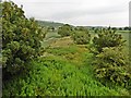
9
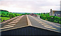
Site of Lodge Hill station, Cheddar Valley 2001
View west, towards Yatton, where it seems all traces of the station and the ex-GWR Yatton - Cheddar - Wells - Witham line have been obliterated and built over with new ?farm sheds since the station and line closed to passengers 9/9/63, although remaining for goods Yatton - Cheddar until 1/10/64. [I think I must have angled this picture for effect!].
Image: © Ben Brooksbank
Taken: 15 May 2001
0.13 miles
10
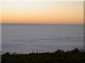
What Somerset used to look like?
A day of freezing fog and minimal winds have brought some dense fog to cover the low levels of the old county. Once the county's lower parts would have been under water, or at least marshy and would have perhaps looked not unlike this.
Image: © Neil Owen
Taken: 1 Dec 2016
0.16 miles