IMAGES TAKEN NEAR TO
High Green, WELLS, BA5 1EG
Introduction
This page details the photographs taken nearby to High Green, BA5 1EG by members of the Geograph project.
The Geograph project started in 2005 with the aim of publishing, organising and preserving representative images for every square kilometre of Great Britain, Ireland and the Isle of Man.

There are currently over 7.5m images from over14,400 individuals and you can help contribute to the project by visiting https://www.geograph.org.uk
Image Map
Images are licensed for reuse under creativecommons.org/licenses/by-sa/2.0
Notes
- Clicking on the map will re-center to the selected point.
- The higher the marker number, the further away the image location is from the centre of the postcode.
Image Listing (21 Images Found)
Images are licensed for reuse under creativecommons.org/licenses/by-sa/2.0
Image
Details
Distance
2
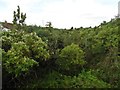
Line of old 'Strawberry' railway trackbed at Easton
Perhaps in need of some light weeding.
Nearby, in the 1960's: Image
Image: © Roger Cornfoot
Taken: 17 Aug 2020
0.06 miles
4
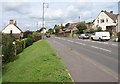
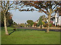
A371 at Easton
The main road to Cheddar climbs a little through the west end of the village. Taken from the same spot as Image
Image: © Derek Harper
Taken: 15 Aug 2011
0.09 miles
6
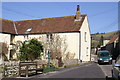
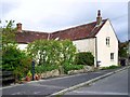
Cottage at Easton
The bench was to commemorate the Queens Silver Jubilee 1952 to 1977
Image: © Adrian and Janet Quantock
Taken: 19 Mar 2006
0.10 miles
7
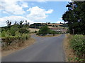
Road Junction
Junction of Ebbor Vale Lane and Priddy Veal Lane
Image: © PAUL FARMER
Taken: 11 Jul 2018
0.10 miles
9
Fields at Easton
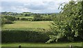
A view from the A371 at Easton past an apple tree and across a meadow, with Knowle Hill across the levels.
Image: © Derek Harper
Taken: 15 Aug 2011
0.11 miles