
IMAGES TAKEN NEAR TO
Glencot Lane, WELLS, BA5 1BH
Introduction
This page details the photographs taken nearby to Glencot Lane, BA5 1BH by members of the Geograph project.
The Geograph project started in 2005 with the aim of publishing, organising and preserving representative images for every square kilometre of Great Britain, Ireland and the Isle of Man.

There are currently over 7.5m images from over14,400 individuals and you can help contribute to the project by visiting https://www.geograph.org.uk
Image Map
Images are licensed for reuse under creativecommons.org/licenses/by-sa/2.0
Notes
- Clicking on the map will re-center to the selected point.
- The higher the marker number, the further away the image location is from the centre of the postcode.
Image Listing (19 Images Found)
Images are licensed for reuse under creativecommons.org/licenses/by-sa/2.0
Image
Details
Distance
1
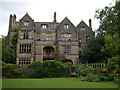
Glencot House
Historical house having been a crammer school in the 1950's has now been restored and is a beautiful restaurant and inn with beautifully restored gardens.
Image: © judy buckingham
Taken: 15 Sep 2004
0.04 miles
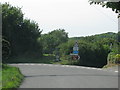
3
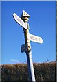
Direction Sign - Signpost south of Wookey Hole
Pyramid finial - 3 arms; Somerset SCC pyramid by the UC road, in parish of St Cuthbert Out (Mendip District), on the south side of the Y junction of Glencot Lane and Wells Road.
surveyed
Milestone Society National ID: SO_ST5347B
Image: © Milestone Society
Taken: 2 Feb 2013
0.11 miles
4
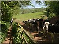
Bullocks near Wookey Hole
As our party included a dog we were glad these frisky animals were behind a fence. This is where the West Mendip Way, having arrived at Lime Kiln Lane, immediately turns away towards the village.
Image: © Derek Harper
Taken: 22 May 2010
0.13 miles
5

Direction Sign - Signpost south of Wookey Hole
Pyramid finial - 3 arms; Somerset SCC pyramid by the UC road, in parish of St Cuthbert Out (Mendip District), on the southeast side of the T junction of Glencot Lane, Glencot Road and a lane to the A371.
surveyed
Milestone Society National ID: SO_ST5346B
Image: © Milestone Society
Taken: 2 Feb 2013
0.15 miles
6

Jogging up the lane
The hedgerows on each side are very broad and can only be cut mechanically.
Image: © Bill Boaden
Taken: 30 Dec 2016
0.17 miles
7
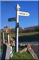
Old Direction Sign - Signpost by Glencot Road, St Cuthbert Out Parish
Pyramid finial - 3 arms; Somerset SCC pyramid by the UC road, in parish of St Cuthbert Out (Mendip District), Glencot Road, junction with Wells Road and Wookey Hole Road.
Surveyed
Milestone Society National ID: SO_ST5346A.
Image: © Milestone Society
Taken: 2 Feb 2013
0.19 miles
8
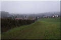
Path to Wookey Hole
Approaching the village using a fairly muddy path on a misty day.
Image: © Bill Boaden
Taken: 30 Dec 2016
0.20 miles
9
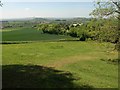
Slopes below Arthur's Point
From the West Mendip Way as it follows footpath WS 10/13H down towards Lime Kiln Lane, running beside the next field boundary. In the distance, left of centre, is the view seen from higher up the hill in Image Right of centre is Image
Image: © Derek Harper
Taken: 22 May 2010
0.20 miles
10
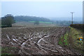
Muddy field near Marley Grange
Some ploughing is taking place down the slope to the right, though I would not have thought conditions are ideal. The view is towards Wookey Hole and the Mendips behind are shrouded in mist.
Image: © Bill Boaden
Taken: 30 Dec 2016
0.20 miles