
IMAGES TAKEN NEAR TO
Rodmore Crescent, SHEPTON MALLET, BA4 6JJ
Introduction
This page details the photographs taken nearby to Rodmore Crescent, BA4 6JJ by members of the Geograph project.
The Geograph project started in 2005 with the aim of publishing, organising and preserving representative images for every square kilometre of Great Britain, Ireland and the Isle of Man.

There are currently over 7.5m images from over14,400 individuals and you can help contribute to the project by visiting https://www.geograph.org.uk
Image Map
Images are licensed for reuse under creativecommons.org/licenses/by-sa/2.0
Notes
- Clicking on the map will re-center to the selected point.
- The higher the marker number, the further away the image location is from the centre of the postcode.
Image Listing (66 Images Found)
Images are licensed for reuse under creativecommons.org/licenses/by-sa/2.0
Image
Details
Distance
1
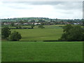
Evercreech from a hill to the south
A small and un-named hill is a high-point to view the town from.
Image: © Neil Owen
Taken: 17 Jun 2019
0.03 miles
2

The Old Chapel
Former Wesleyan Chapel built in 1872, built next to an earlier building of 1826 which it replaced. It closed in 2003 and is now in residential use.
Image: © Ian Capper
Taken: 8 Aug 2025
0.10 miles
3
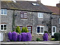
Cottages in Orchard Lane
Purple cushions of flowers tumble over the garden walls of these cottages.
Image: © J Tucker
Taken: 3 Apr 2007
0.10 miles
4

Boarded Methodist chapel
This part of the Wesleyan church looks closed to parishioners. It was founded in 1826 but is now a private residence. A benchmark can just be made out to the right of the doorway. See https://www.bench-marks.org.uk/bm109678 for the entry in the Benchmark Database.
Image: © Neil Owen
Taken: 12 Jul 2019
0.10 miles
5

Fernleigh Close
Cul-de-sac off Weymouth Road, built in 2004.
Image: © Ian Capper
Taken: 8 Aug 2025
0.11 miles
6
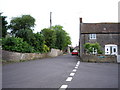
Weston Town, Evercreech
The road into Evercreech from the south.
Image: © J Tucker
Taken: 13 Jun 2006
0.11 miles
8
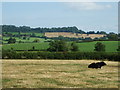
A solitary cow near Evercreech
A lone diner, but close to the adjoining field where there were many cows of various breeds.
Image: © Neil Owen
Taken: 12 Jul 2019
0.12 miles
9

Brewers House
Former pub on Weymouth Road, The Brewers Arms, which closed at the end of 2004 and is now in residential use. Dating from the early 19th Century it is grade II listed - see https://historicengland.org.uk/listing/the-list/list-entry/1238463?section=official-list-entry.
Image: © Ian Capper
Taken: 8 Aug 2025
0.13 miles
10
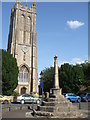
Evercreech cross and church
The village market cross, once part of the churchyard but now relocated a short distance away, stands at the junction of Bruton Road and Oxford Street. It dates from the fifteenth century, with a major restoration of the shaft and cross itself in the nineteenth. Grade II* listed.
Image: © Neil Owen
Taken: 12 Jul 2019
0.15 miles