IMAGES TAKEN NEAR TO
Maesdown Hill, SHEPTON MALLET, BA4 6EG
Introduction
This page details the photographs taken nearby to Maesdown Hill, BA4 6EG by members of the Geograph project.
The Geograph project started in 2005 with the aim of publishing, organising and preserving representative images for every square kilometre of Great Britain, Ireland and the Isle of Man.

There are currently over 7.5m images from over14,400 individuals and you can help contribute to the project by visiting https://www.geograph.org.uk
Image Map
Images are licensed for reuse under creativecommons.org/licenses/by-sa/2.0
Notes
- Clicking on the map will re-center to the selected point.
- The higher the marker number, the further away the image location is from the centre of the postcode.
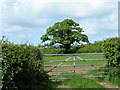
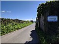
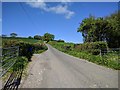
Image Listing (6 Images Found)
Images are licensed for reuse under creativecommons.org/licenses/by-sa/2.0
Image
Details
Distance
2

2011 : East of south from Maesdown Hill
Maes Down Farm is at the bottom of the hill with Stoney Stratton in the valley beyond.
Image: © Maurice Pullin
Taken: 4 Jul 2011
0.05 miles

5
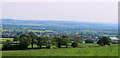
2011 : West of south on Maesdown Hill
Pastures, hedgerows and trees to the bottom of the hill then a tantalising glimpse of Evercreech.
The horizon appears to slope, an effect caused by the Somerset Levels which begin a short distance over to the right. Not the photographer this time.
Image: © Maurice Pullin
Taken: 4 Jul 2011
0.22 miles