
IMAGES TAKEN NEAR TO
Alham, SHEPTON MALLET, BA4 6DG
Introduction
This page details the photographs taken nearby to Alham, BA4 6DG by members of the Geograph project.
The Geograph project started in 2005 with the aim of publishing, organising and preserving representative images for every square kilometre of Great Britain, Ireland and the Isle of Man.

There are currently over 7.5m images from over14,400 individuals and you can help contribute to the project by visiting https://www.geograph.org.uk
Image Map
Images are licensed for reuse under creativecommons.org/licenses/by-sa/2.0
Notes
- Clicking on the map will re-center to the selected point.
- The higher the marker number, the further away the image location is from the centre of the postcode.
Image Listing (4 Images Found)
Images are licensed for reuse under creativecommons.org/licenses/by-sa/2.0
Image
Details
Distance
1
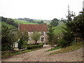
Lower Alham Farm
Higher Alham is not high compared to Chesterblade but it is higher than Lower Alham, which nestles deeper into the valley.
Image: © Zorba the Geek
Taken: 6 Oct 2007
0.10 miles
2
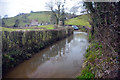
Lower Alham Farm Ford
This ford is found on Lower Alham Farm. The ford forms part of the annual South West Centre Kimber Classic Trial for classic MG's;
https://www.facebook.com/MGCCSW/videos?fref=photo
Image: © John Walton
Taken: 18 Mar 2016
0.16 miles
3
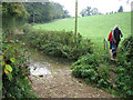
The track goes through the stream, but
the footpath is able to bypass the ford. Track close to Lower Alham Farm.
Image: © Zorba the Geek
Taken: 6 Oct 2007
0.17 miles
4
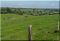
Looking down the valley, Ellingham wood on the left.
Image: © Phil Taylor
Taken: 11 Jul 2007
0.21 miles