
IMAGES TAKEN NEAR TO
Coombe View, SHEPTON MALLET, BA4 5YF
Introduction
This page details the photographs taken nearby to Coombe View, BA4 5YF by members of the Geograph project.
The Geograph project started in 2005 with the aim of publishing, organising and preserving representative images for every square kilometre of Great Britain, Ireland and the Isle of Man.

There are currently over 7.5m images from over14,400 individuals and you can help contribute to the project by visiting https://www.geograph.org.uk
Image Map
Images are licensed for reuse under creativecommons.org/licenses/by-sa/2.0
Notes
- Clicking on the map will re-center to the selected point.
- The higher the marker number, the further away the image location is from the centre of the postcode.
Image Listing (50 Images Found)
Images are licensed for reuse under creativecommons.org/licenses/by-sa/2.0
Image
Details
Distance
1
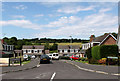
2011 : Westleigh Gardens, Shepton Mallet
A cul-de-sac off Shaftgate Avenue.
These chalet bungalows are typical of the 1960's and 70's. Comfortable well-built houses but the roofs may need resurfacing after 20 years or more. Copper sheet is suggested if you can get it.
Image: © Maurice Pullin
Taken: 11 Jun 2011
0.02 miles
2
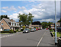
2011 : Shaftgate Avenue, Shepton Mallet
Off the A371 Commercial Road.
Would think it a residential development of the 1960's or 70's, these chalet bungalows are typical of the period.
Image: © Maurice Pullin
Taken: 11 Jun 2011
0.08 miles
3
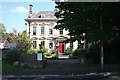
Shepton Mallet: Bowlish House
A Georgian clothier’s house built in 1732. It has since served as a restaurant
Image: © Martin Bodman
Taken: 21 Sep 2008
0.09 miles
4
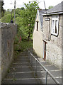
The steps down Pembroke Cottage
A steep flight of steps takes walkers down from Pike Hill to the River Sheppey.
Image: © Neil Owen
Taken: 21 May 2014
0.10 miles
5
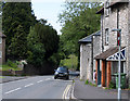
2011 : A371 heading down Pike Hill skirting Shepton Mallet
From here the A371 goes west to Wells then along the foot of the Mendips to Cheddar and Axbridge.
Image: © Maurice Pullin
Taken: 11 Jun 2011
0.10 miles
6
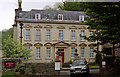
Bowlish House, Shepton Mallet
One of several big houses in Bowlish - this dates from 1732. Every window has a triangular or segmental pediment. The general proportions suggest early C18th and a provincial builder at work. Grade II* listed.
It is now a hotel and restaurant.
Image: © Stephen Richards
Taken: 13 May 2004
0.10 miles
7
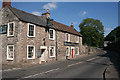
Shepton Mallet: The Horseshoe Inn
By the Shepton Mallet - Wells road, which was only constructed through the valley in the 19th century. Behind the inn stood one of Shepton’s silk mills which was demolished in 1974, according to Robin Bush [Somerset, The Complete Guide. Dovecote Press, 1994]
Image: © Martin Bodman
Taken: 21 Sep 2008
0.10 miles
8
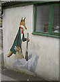
The hunted turned the hunter
A sly and somewhat suspicious looking country character on the wall of a house. Further investigation revealed that a Leicester fan lived there.
Image: © Neil Owen
Taken: 21 May 2014
0.11 miles
9
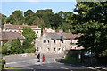
Shepton Mallet: Bowlish
Old Bowlish House is half hidden by the road junction. The Horseshoe Inn stands by the Shepton - Wells road, constructed in the 19th century. The old road runs behind the inn. On the right, in shadow, under the tree, is the entrance to Bowlish House, like Old Bowlish House, originally constructed for a wealthy cloth merchant, but more recently functioning as a restaurant
Image: © Martin Bodman
Taken: 21 Sep 2008
0.11 miles
10
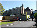
Former brewery maltings, Shepton Mallet
This large complex is a former brewery and maltings built in 1872 but closed in the 1930s and now in multiple occupancy. This view is of the old maltings with a square kiln and a stepped square brick chimney. This is one of three standing chimneys on site but is the least attractive.
Image: © Chris Allen
Taken: 31 Aug 2014
0.11 miles