IMAGES TAKEN NEAR TO
The Batch, SHEPTON MALLET, BA4 5HW
Introduction
This page details the photographs taken nearby to The Batch, BA4 5HW by members of the Geograph project.
The Geograph project started in 2005 with the aim of publishing, organising and preserving representative images for every square kilometre of Great Britain, Ireland and the Isle of Man.

There are currently over 7.5m images from over14,400 individuals and you can help contribute to the project by visiting https://www.geograph.org.uk
Image Map
Images are licensed for reuse under creativecommons.org/licenses/by-sa/2.0
Notes
- Clicking on the map will re-center to the selected point.
- The higher the marker number, the further away the image location is from the centre of the postcode.
Image Listing (258 Images Found)
Images are licensed for reuse under creativecommons.org/licenses/by-sa/2.0
Image
Details
Distance
1

Footbridge over the Sheppey
Part of the Lower Lane area of Shepton Mallet and the river that runs down here makes for an interesting little bridge over it.
Image: © Neil Owen
Taken: 21 May 2014
0.02 miles
2

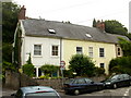
27 Peter Street, Shepton Mallett
Dates from about 1750 https://historicengland.org.uk/listing/the-list/list-entry/1058391
Image: © Jonathan Thacker
Taken: 23 Sep 2021
0.02 miles
3

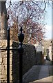
Entrance to The Old Rectory. Shepton Mallett
Image: © Jonathan Thacker
Taken: 23 Sep 2021
0.02 miles
4

Peter Street Rooms, Shepton Mallett
Dates from about 1800 https://historicengland.org.uk/listing/the-list/list-entry/1173468
Image: © Jonathan Thacker
Taken: 23 Sep 2021
0.03 miles
5
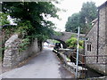
North side of Leg Square, Shepton Mallet
Numbers 4-6 Leg Square.
Lower Lane, on the left side of the houses, leads to a bridge with a headroom of 7 feet and a maximum width of 6 feet 6 inches. http://www.geograph.org.uk/photo/2053645
Image: © Jaggery
Taken: 7 Jul 2010
0.04 miles
6
Shepton Mallet : low bridge ahead - and a glimpse of the River Sheppey
The arched bridge which carries Edengrove Lane across Lower Lane has a headroom of 7 feet and maximum width of 6 feet 6 inches.
Much of the course of the River Sheppey through Shepton Mallet is in underground culverts. Only rarely does the river surface - as here, visible in the lower right corner.
Image: © Jaggery
Taken: 7 Jul 2010
0.04 miles
7

Footpath to Barren Down
The path crosses over the River Sheppy here.
Image: © Neil Owen
Taken: 21 May 2014
0.04 miles
8
Public footpath looking North from the Churchyard, Shepton Mallet
Another attractive part of the public footpath in and around the church of St Peter and St Paul
Image: © Tom Jolliffe
Taken: 26 Mar 2007
0.04 miles
9
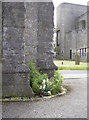
St Peter and St Paul's benchmark
A cutmark, as listed in the Benchmark Database: http://www.bench-marks.org.uk/bm45319 , on the northwest angle of the church in the Shambles area of Shepton Mallet.
Image: © Neil Owen
Taken: 30 Jul 2012
0.04 miles
10

Keeping out of the water
The stream running along Lower Lane is well protected as it disappears under the road.
Image: © Neil Owen
Taken: 21 May 2014
0.04 miles