
IMAGES TAKEN NEAR TO
Western Court, SHEPTON MALLET, BA4 5DQ
Introduction
This page details the photographs taken nearby to Western Court, BA4 5DQ by members of the Geograph project.
The Geograph project started in 2005 with the aim of publishing, organising and preserving representative images for every square kilometre of Great Britain, Ireland and the Isle of Man.

There are currently over 7.5m images from over14,400 individuals and you can help contribute to the project by visiting https://www.geograph.org.uk
Image Map
Images are licensed for reuse under creativecommons.org/licenses/by-sa/2.0
Notes
- Clicking on the map will re-center to the selected point.
- The higher the marker number, the further away the image location is from the centre of the postcode.
Image Listing (71 Images Found)
Images are licensed for reuse under creativecommons.org/licenses/by-sa/2.0
Image
Details
Distance
1
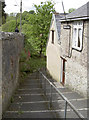
The steps down Pembroke Cottage
A steep flight of steps takes walkers down from Pike Hill to the River Sheppey.
Image: © Neil Owen
Taken: 21 May 2014
0.03 miles
2
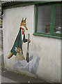
The hunted turned the hunter
A sly and somewhat suspicious looking country character on the wall of a house. Further investigation revealed that a Leicester fan lived there.
Image: © Neil Owen
Taken: 21 May 2014
0.03 miles
3
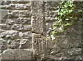
Along the lane
Between Pike Hill and Draycott Road is a steep set of steps that lead past Pembroke Cottage. In the middle of the lane as it reaches the river is a benchmark, dating from the nineteenth century. See http://www.bench-marks.org.uk/bm57554 for the entry in the Benchmark Database and Image] for a wider view.
Image: © Neil Owen
Taken: 21 May 2014
0.04 miles
4
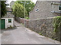
Old lane, modern houses
This little lane rises steeply up to Commercial Road. It comfortably predates the 1970s houses on the right. A benchmark can be found on the (now blocked) gateway in the wall - see Image
Image: © Neil Owen
Taken: 21 May 2014
0.04 miles
5
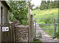
A stroll for some eggs
The footpath leads to the slopes around the River Sheppey at Bowlish. As you're passing, why not pick up half a dozen on the way round?
Image: © Neil Owen
Taken: 21 May 2014
0.05 miles
6
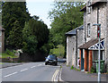
2011 : A371 heading down Pike Hill skirting Shepton Mallet
From here the A371 goes west to Wells then along the foot of the Mendips to Cheddar and Axbridge.
Image: © Maurice Pullin
Taken: 11 Jun 2011
0.05 miles
7
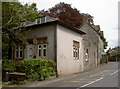
Coming up Pike Hill
The road rises as it becomes Commercial Road and this lodge marks the division. A benchmark can still be found on its corner, although it's not in the condition it ought to be. See Image
Image: © Neil Owen
Taken: 21 May 2014
0.06 miles
8
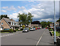
2011 : Shaftgate Avenue, Shepton Mallet
Off the A371 Commercial Road.
Would think it a residential development of the 1960's or 70's, these chalet bungalows are typical of the period.
Image: © Maurice Pullin
Taken: 11 Jun 2011
0.06 miles
9
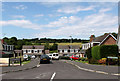
2011 : Westleigh Gardens, Shepton Mallet
A cul-de-sac off Shaftgate Avenue.
These chalet bungalows are typical of the 1960's and 70's. Comfortable well-built houses but the roofs may need resurfacing after 20 years or more. Copper sheet is suggested if you can get it.
Image: © Maurice Pullin
Taken: 11 Jun 2011
0.06 miles
10
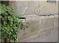
Peeling off the wall
This benchmark (as listed in the Benchmark Database: http://www.bench-marks.org.uk/bm57553 ) has come away from the wall of the lodge! See Image] for a wider view.
Image: © Neil Owen
Taken: 21 May 2014
0.07 miles