
IMAGES TAKEN NEAR TO
Doulting, SHEPTON MALLET, BA4 4QE
Introduction
This page details the photographs taken nearby to BA4 4QE by members of the Geograph project.
The Geograph project started in 2005 with the aim of publishing, organising and preserving representative images for every square kilometre of Great Britain, Ireland and the Isle of Man.

There are currently over 7.5m images from over14,400 individuals and you can help contribute to the project by visiting https://www.geograph.org.uk
Image Map
Images are licensed for reuse under creativecommons.org/licenses/by-sa/2.0
Notes
- Clicking on the map will re-center to the selected point.
- The higher the marker number, the further away the image location is from the centre of the postcode.
Image Listing (57 Images Found)
Images are licensed for reuse under creativecommons.org/licenses/by-sa/2.0
Image
Details
Distance
1
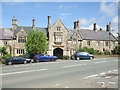
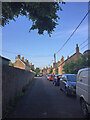
The north terrace of Doulting
The main road (dating from 1871) runs east-west through the village of Doulting. On the northern side is the distinctive terraced buildings. The Paget family became wealthy through quarrying - as did many in this rich stone area. In creating new properties they employed the architect G.J. Skipper, who had gained a reputation after working for the Clark footwear family in Street.
Image: © Neil Owen
Taken: 26 Aug 2020
0.02 miles
2
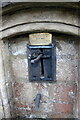
Water Pump in Doulting (detail)
This shows the Brass memorial plate in memory of Scot Pike
Image: © Nigel Mykura
Taken: 5 Nov 2022
0.02 miles
3
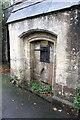
Old Water Pump in Doulting
The pump handle of this pump is now locked. It has an undated brass plate in memory of Scot Pike.
Image: © Nigel Mykura
Taken: 5 Nov 2022
0.02 miles
4
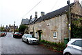
Houses on Church Lane Doulting
At the far end of the house on the right is a small structure housing an old hand pump which was the supply of fresh water for the village . A bit further away is St Aldhelms well which is a much larger spring and the source of the River Sheppey.
Image: © Nigel Mykura
Taken: 5 Nov 2022
0.02 miles
6
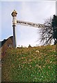
Old Direction Sign - Signpost by the A361, Doulting Parish
Pyramid finial - 1 arm; Somerset SCC pyramid by the A361, in parish of Doulting (Mendip District), junction with Church Lane.
Surveyed
Milestone Society National ID: SO_ST6443A.
Image: © Milestone Society
Taken: Unknown
0.03 miles
7
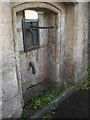
Doulting pump
The old village pump in Church Lane. It lies not too far from St Aldhelm's Well and presumably shares the water source, which is the source of the River Sheppy.
Image: © Neil Owen
Taken: 26 Aug 2020
0.03 miles
8
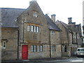
A sturdy red door
Doulting's central area along the main Shepton Mallet road is richly blessed with some fine architecture. The buildings are mainly the work of G.J. Skipper, who also designed much of Street's better buildings for the Clark's footwear organisation.
The door seen here is a proud shade of red and is a ribbed timber plank door. Above is an oriel window.
Image: © Neil Owen
Taken: 26 Aug 2020
0.03 miles
9
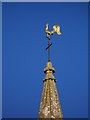
Weather cock, Church of St. Aldelm
It was a papal edict in the 9th century that was responsible for the proliferation of weathercocks on churches. This edict required every Church in Christendom to be mounted by a cockerel. This symbol was to recall Peter's betrayal of Christ (LUKE 22:34) "I tell thee, Peter, the cock shall not crow this day, before that thou shalt thrice deny that thou knowest me". Although only the symbol of the cockerel was required by the edict, the motif, it seems, was quickly wedded with the weathervane. By the 13th century the word for weathercock (gallum) and weathervane (ventrologium) had become interchangeable. Interestingly, early weathercocks did not include cardinal letters, as Christian churches always lay east to west.
Image: © Maigheach-gheal
Taken: 1 Jan 2010
0.04 miles
10
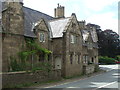
The Neo-vernacular style
Doulting's more recent history revolves around the input made by the Paget family. They employed the architect G.J. Skipper to construct many impressive and stylish buildings in the nineteenth century.
Image: © Neil Owen
Taken: 26 Aug 2020
0.04 miles