IMAGES TAKEN NEAR TO
Downhead, SHEPTON MALLET, BA4 4LQ
Introduction
This page details the photographs taken nearby to BA4 4LQ by members of the Geograph project.
The Geograph project started in 2005 with the aim of publishing, organising and preserving representative images for every square kilometre of Great Britain, Ireland and the Isle of Man.

There are currently over 7.5m images from over14,400 individuals and you can help contribute to the project by visiting https://www.geograph.org.uk
Image Map
Images are licensed for reuse under creativecommons.org/licenses/by-sa/2.0
Notes
- Clicking on the map will re-center to the selected point.
- The higher the marker number, the further away the image location is from the centre of the postcode.
Image Listing (12 Images Found)
Images are licensed for reuse under creativecommons.org/licenses/by-sa/2.0
Image
Details
Distance
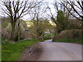
3
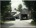
Footpath, Downhead
The footpath allows walkers to reach Great Gains Wood and is part of the East Mendip Way.
Image: © Maigheach-gheal
Taken: 1 Jan 2010
0.09 miles
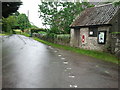
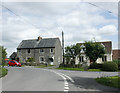
4
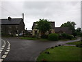
Road junction, Downhead
At the junction there is a postbox and the village notice board.
Image: © Maigheach-gheal
Taken: 1 Jan 2010
0.12 miles
5
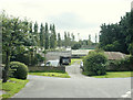
2009 : Ashley Farm, Pound Lane, Downhead
Having used an image of the farm the least I can do is give a link: http://www.cylex-uk.co.uk/company/a-urch-12731109.html
Image: © Maurice Pullin
Taken: 3 Aug 2009
0.17 miles
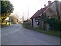
7
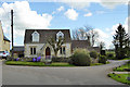
The Old School House, Downhead
Grade II listed, mid 19th century.
Image: © Robin Webster
Taken: 2 Apr 2017
0.18 miles
8
2009 : Green Farm, Downhead
Not just another farm.
"Green Farm is a dairy farm on the Mendip hills with 300 milking cows and 200 followers (small heifer calves up to animals about to have their first calf). The farm lies between 600 and 900 feet above sea level and has an average of 48 inches of rain per annum."
The above was copied from: http://www.shutefarmstudio.org.uk/green_farm.htm
There is more.
Image: © Maurice Pullin
Taken: 3 Aug 2009
0.20 miles
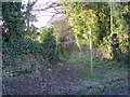
9
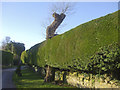
Growing around a tree
Some well tended residential hedging, surrounding a larger but less verdant tree.
Image: © Neil Owen
Taken: 29 Nov 2019
0.20 miles
10
2009 : Cottages on Pound Lane, Downhead
A few hundred yards north of Merehead Quarry.
Image: © Maurice Pullin
Taken: 3 Aug 2009
0.20 miles