
IMAGES TAKEN NEAR TO
Green Lane, RADSTOCK, BA3 4TB
Introduction
This page details the photographs taken nearby to Green Lane, BA3 4TB by members of the Geograph project.
The Geograph project started in 2005 with the aim of publishing, organising and preserving representative images for every square kilometre of Great Britain, Ireland and the Isle of Man.

There are currently over 7.5m images from over14,400 individuals and you can help contribute to the project by visiting https://www.geograph.org.uk
Image Map
Images are licensed for reuse under creativecommons.org/licenses/by-sa/2.0
Notes
- Clicking on the map will re-center to the selected point.
- The higher the marker number, the further away the image location is from the centre of the postcode.
Image Listing (20 Images Found)
Images are licensed for reuse under creativecommons.org/licenses/by-sa/2.0
Image
Details
Distance
1
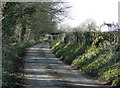
2009 : West on Sweet Leaze Lane
It's as well the nearby collieries are closed.
Image: © Maurice Pullin
Taken: 22 Mar 2009
0.07 miles
2
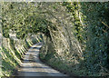
2009 : East on Sweet Leaze Lane
At least two disused collieries within half a mile of here.
Image: © Maurice Pullin
Taken: 22 Mar 2009
0.08 miles
3
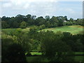
A view of the other hill from T'other Side The Hill
In between is the valley known as Moon's Bottom.
Image: © Neil Owen
Taken: 20 Aug 2020
0.09 miles
4
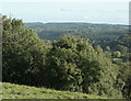
2009 : East of south at the end of Coalpit Lane
Another view from that wall, looking more to the east this time.
Little to be seen now of the disused coal mines at the bottom of this valley.
On the skyline to the left, Cranmore Tower Image
Image: © Maurice Pullin
Taken: 10 Oct 2009
0.10 miles
5
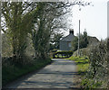
2009 : The western end of Sweet Leaze Lane
Image: © Maurice Pullin
Taken: 22 Mar 2009
0.11 miles
6
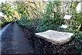
Fly Tipping at Middle Wood
Middle Wood is adjacent to a narrow lane that runs north from the B3356 at Sweetleaze Farm towards Chilcommpton. There is obviously a fly tipping problem because of the large number of signs prohibiting such activity.
Image: © Nigel Mykura
Taken: 19 Dec 2020
0.13 miles
7
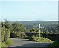
2009 : Signpost at the end of Coalpit Lane
Stratton-on-the-Fosse to the left Gurney Slade to the right.
Wait till you see the view over the wall.
Image: © Maurice Pullin
Taken: 10 Oct 2009
0.13 miles
9
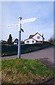
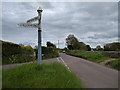
Old Direction Sign - Signpost by Stock Hill, Chilcompton Parish
Pyramid finial - 3 arms; Somerset SCC pyramid by the UC road, in parish of Chilcompton (Mendip District), Stockhill Road junction with Stock Hill.
Surveyed
Milestone Society National ID: SO_ST6449B
Image: © Milestone Society
Taken: Unknown
0.14 miles
10
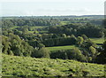
2009 : Over the wall at the end of Coalpit Lane
Looking into Moon's Bottom.
Further over where else but "T'other Side the Hill." Yes, that is what it is called.
If you were wondering about the coalpits in Coalpit Lane they were down there, but very little to be seen of them now.
Image: © Maurice Pullin
Taken: 10 Oct 2009
0.15 miles