
IMAGES TAKEN NEAR TO
Lower Farm Lane, BATH, BA2 9AQ
Introduction
This page details the photographs taken nearby to Lower Farm Lane, BA2 9AQ by members of the Geograph project.
The Geograph project started in 2005 with the aim of publishing, organising and preserving representative images for every square kilometre of Great Britain, Ireland and the Isle of Man.

There are currently over 7.5m images from over14,400 individuals and you can help contribute to the project by visiting https://www.geograph.org.uk
Image Map
Images are licensed for reuse under creativecommons.org/licenses/by-sa/2.0
Notes
- Clicking on the map will re-center to the selected point.
- The higher the marker number, the further away the image location is from the centre of the postcode.
Image Listing (47 Images Found)
Images are licensed for reuse under creativecommons.org/licenses/by-sa/2.0
Image
Details
Distance
1
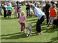
Getting the entrants' details
An enthusiastic owner entering the dog show. The pet seems less keen, though.
Image: © Neil Owen
Taken: 16 Jul 2011
0.06 miles
2
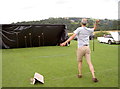
Have a shy!
The traditional fete temptation, with a catch mat draped over the football goals. Referee!
Image: © Neil Owen
Taken: 21 Jul 2012
0.06 miles
3
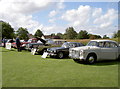
Gleaming metal
Corston Fête also features a lot of classic motors.
Image: © Neil Owen
Taken: 16 Jul 2011
0.06 miles
4
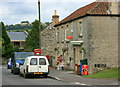
2008 : Corston Post Office and greengrocery
The road links the A36 and the A4.
Kelston Round Hill is on the skyline. Image
Image: © Maurice Pullin
Taken: 8 Sep 2008
0.06 miles
5
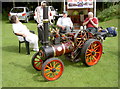
A little steamed up
A fully functioning but slightly smaller than usual stream engine.
Image: © Neil Owen
Taken: 21 Jul 2012
0.07 miles
6
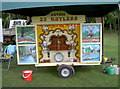
Music without keys
A steam organ at the Fête.
Image: © Neil Owen
Taken: 16 Jul 2011
0.07 miles
7
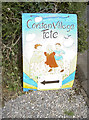
F?te today!
Sign proclaiming the village's annual celebration on the playing fields.
Image: © Neil Owen
Taken: 16 Jul 2011
0.07 miles
8
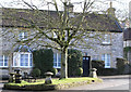
Corston Triangle
This grass triangle is very close to the Post Office. Notice the staddle stones which were once used to support granaries above the ground thereby protecting the stored grain from vermin and water seepage. The house on the right of the terrace is called the old bakery.
Image: © Rick Crowley
Taken: 21 Feb 2010
0.07 miles
9
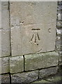
Cut benchmark, Corston
The cutmark is listed on the Benchmark Database: http://www.bench-marks.org.uk/bm37049.
See Image] for wider view.
Image: © Neil Owen
Taken: 18 Feb 2011
0.08 miles
10
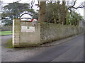
Entrance to St Teresa's Nursing Home, Corston
This former convent is now a highly appointed care home for the elderly. On the right hand side is a cut benchmark as listed in the database http://benchmarks.ordnancesurvey.co.uk/pls/htmldb/f?p=111:3:589717760497752108::NO::P3_HIDDEN:true.
See Image] for a close view
Image: © Neil Owen
Taken: 18 Feb 2011
0.08 miles