
IMAGES TAKEN NEAR TO
Claverton Down Road, BATH, BA2 7WW
Introduction
This page details the photographs taken nearby to Claverton Down Road, BA2 7WW by members of the Geograph project.
The Geograph project started in 2005 with the aim of publishing, organising and preserving representative images for every square kilometre of Great Britain, Ireland and the Isle of Man.

There are currently over 7.5m images from over14,400 individuals and you can help contribute to the project by visiting https://www.geograph.org.uk
Image Map
Images are licensed for reuse under creativecommons.org/licenses/by-sa/2.0
Notes
- Clicking on the map will re-center to the selected point.
- The higher the marker number, the further away the image location is from the centre of the postcode.
Image Listing (38 Images Found)
Images are licensed for reuse under creativecommons.org/licenses/by-sa/2.0
Image
Details
Distance
1

Wessex Water offices on Claverton Down
The modern offices are part of the Operations Centre of the water firm. They stand on the site of the former Bath Statutory Hospital. The latter was founded in 1876 as the Infectious Diseases hospital, with several wooden buildings and some tents! These were replaced from 1931 when Bath city architect F.P. Sisson drew up plans for a new set of proper buildings, including isolation wards, offices and ward blocks. From 1948 geriatric blocks were added. The hospital provided help until 1989, when things were wound down prior to closure.
Image: © Neil Owen
Taken: 16 May 2020
0.03 miles
2
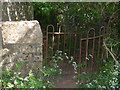
Brassknocker gate
A fine old iron kissing gate halfway on the footpath from Claverton Down Road to Brassknocker Hill.
Image: © Neil Owen
Taken: 16 May 2020
0.05 miles
3
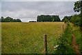
Bath : Grassy Field
A grassy field and right of way alongside it.
Image: © Lewis Clarke
Taken: 6 Aug 2020
0.05 miles
4

Bath : Grassy Field
A grassy field on the outskirts of Bath.
Image: © Lewis Clarke
Taken: 6 Aug 2020
0.05 miles
5

Bath : Footpath
A footpath heads into Bath.
Image: © Lewis Clarke
Taken: 6 Aug 2020
0.07 miles
6
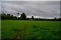
Bath : Grassy Field
A right of way heads through the field.
Image: © Lewis Clarke
Taken: 6 Aug 2020
0.08 miles
7
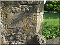
Historical vandalism?
The end of the wall on Claverton Down Road has some personal markings.
Image: © Neil Owen
Taken: 16 May 2020
0.08 miles
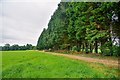
9

Bath : Claverton Down Road
Looking along the road through Claverton Down near Monkton Combe.
Image: © Lewis Clarke
Taken: 6 Aug 2020
0.10 miles
10

Monkton Combe : Combe Edge
Combe Edge on Brassknocker Hill.
Image: © Lewis Clarke
Taken: 6 Aug 2020
0.11 miles