
IMAGES TAKEN NEAR TO
Middle Stoke, BATH, BA2 7GG
Introduction
This page details the photographs taken nearby to Middle Stoke, BA2 7GG by members of the Geograph project.
The Geograph project started in 2005 with the aim of publishing, organising and preserving representative images for every square kilometre of Great Britain, Ireland and the Isle of Man.

There are currently over 7.5m images from over14,400 individuals and you can help contribute to the project by visiting https://www.geograph.org.uk
Image Map
Images are licensed for reuse under creativecommons.org/licenses/by-sa/2.0
Notes
- Clicking on the map will re-center to the selected point.
- The higher the marker number, the further away the image location is from the centre of the postcode.
Image Listing (28 Images Found)
Images are licensed for reuse under creativecommons.org/licenses/by-sa/2.0
Image
Details
Distance
1

Daniell monument, Limpley Stoke
A very grand chest tomb "with urn finial on fluted plinth" https://www.historicengland.org.uk/listing/the-list/list-entry/1285575 . To Francis Clisild Daniell, who died on 3rd February 1857 aged 37 - and to Joseph Clisild Daniell, presumably his father, who died on 11th March 1862 aged 79, a clothier who patented a number of inventions for the manufacture of woollen cloth.
Image: © Derek Harper
Taken: 23 Feb 2016
0.11 miles
2

Daniell monument, Limpley Stoke
The "damaged oval inscription tablet" https://www.historicengland.org.uk/listing/the-list/list-entry/1285575 on the other side of the chest tomb shown in Image], providing the information I gave in that description. I've ramped up the contrast to try to reveal the inscription, rather unsuccessfully, I'm afraid. "Resurgam" is fairly clear, though.
Image: © Derek Harper
Taken: 23 Feb 2016
0.11 miles
3
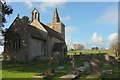
St Mary's church, Limpley Stoke
According to http://history.wiltshire.gov.uk/community/getimage.php?id=4630 . the dedication was once to St Edith. The grade II* church https://www.historicengland.org.uk/listing/the-list/list-entry/1364104 is on the southern edge of the village and nearer Freshford than much of Limpley Stoke.
Image: © Derek Harper
Taken: 23 Feb 2016
0.11 miles
4
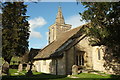
St Mary's church, Limpley Stoke
Image] shows the grade II* church https://www.historicengland.org.uk/listing/the-list/list-entry/1364104 from the other side. According to Pevsner (1963) "small, unrestored, little-known".
Image: © Derek Harper
Taken: 23 Feb 2016
0.11 miles
5
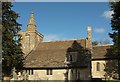
St Mary's church, Limpley Stoke
The grade II* listed church https://www.historicengland.org.uk/listing/the-list/list-entry/1364104 is also shown at Image] and Image Pevsner claimed in 1963 that the church was little-known, but I'm still surprised that no pictures of it have previously been submitted.
Image: © Derek Harper
Taken: 23 Feb 2016
0.11 miles
6
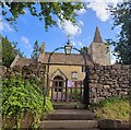
Church of Saint Mary the Virgin - Limpley Stoke
Image: © Anthony Parkes
Taken: 27 May 2024
0.11 miles
7
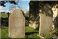
Gravestone, St Mary's church, Limpley Stoke
A pair of decorated gravestones on the south side of the church: on the left, to Harriet Allen †1881, and on the right, Vincent Steer †1914.
Image: © Derek Harper
Taken: 23 Feb 2016
0.12 miles
8
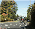
2009 : A36 with tractor, near Limpley Stoke
The car waiting to pull out on the right is coming from Freshford.
Arrows on the road indicate the by-road to Midford.
Image: © Maurice Pullin
Taken: 8 Oct 2009
0.13 miles
9

Churchyard, Limpley Stoke
The churchyard of St Mary's, on the southern edge of the village and nearer Freshford than much of Limpley Stoke.
Image: © Derek Harper
Taken: 23 Feb 2016
0.13 miles
10
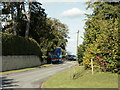
2009 : Midford Lane, the diverted section
The A36 is immediately behind the camera position.
See also Image]
Image: © Maurice Pullin
Taken: 8 Oct 2009
0.17 miles