
IMAGES TAKEN NEAR TO
Abbey View Gardens, BATH, BA2 6DQ
Introduction
This page details the photographs taken nearby to Abbey View Gardens, BA2 6DQ by members of the Geograph project.
The Geograph project started in 2005 with the aim of publishing, organising and preserving representative images for every square kilometre of Great Britain, Ireland and the Isle of Man.

There are currently over 7.5m images from over14,400 individuals and you can help contribute to the project by visiting https://www.geograph.org.uk
Image Map
Images are licensed for reuse under creativecommons.org/licenses/by-sa/2.0
Notes
- Clicking on the map will re-center to the selected point.
- The higher the marker number, the further away the image location is from the centre of the postcode.
Image Listing (304 Images Found)
Images are licensed for reuse under creativecommons.org/licenses/by-sa/2.0
Image
Details
Distance
1
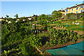
Allotments by the Canal
The land sloping up from the Kennet and Avon Canal has been turned into allotments where city dwellers can grown their own fruit and vegetables.
Image: © Anne Burgess
Taken: 10 May 2018
0.03 miles
2
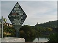
Old GWR Canal Bridge Sign, Pulteney Road
This sign dates to the early years of the 20th Century, from the days when the Kennet and Avon Canal was owned (and progressively run down) by the Great Western Railway. The canal behind is roughly mid way down the Widcombe Flight.
Image: © mark harrington
Taken: 9 Sep 2004
0.03 miles
3
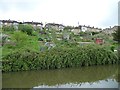
Canalside allotments between locks 12 and 11, Bath
Below the houses in Abbey View Gardens.
Image: © Christine Johnstone
Taken: 2 May 2015
0.03 miles
4

Abbey View Allotments
The allotments slope down to the Kennet and Avon Canal. The towpath runs beside the back garden walls of the terraced houses.
Image: © Rose and Trev Clough
Taken: 31 Oct 2011
0.04 miles
5

Benchmark on gatepost of #1 The Tyning
Ordnance Survey cut mark benchmark described on the Bench Mark Database at http://www.bench-marks.org.uk/bm35428.
Image: © Roger Templeman
Taken: 3 Sep 2010
0.04 miles
6
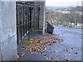
Steep drop
Looking from The Tyning down the steep hill into Abbey View. The awkward angle of the ground has meant a certain variation of the gates to ensure they account for it. Also note it is a good place to check the levels, hence the Ordnanace Survey benchmark on the pillar. See http://www.bench-marks.org.uk/bm35428 for the entry in the Benchmark Database.
Image: © Neil Owen
Taken: 25 Nov 2011
0.04 miles
7

Wash House Lock No 10, Kennet and Avon Canal, Bath
As seen in 1977
Image: © Dr Neil Clifton
Taken: 25 Sep 1977
0.04 miles
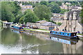
9
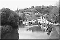
The Kennet & Avon at Bath
Taken from the bridge carrying Pulteney Gardens over the canal. St Luke's church is visible in the background.
Image: © John Winder
Taken: 9 Nov 2016
0.06 miles
10
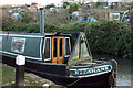
Redshank, Kennet & Avon Canal
The stern of the craft shown in Image, here moored near Wash House Lock. Across the canal are Abbey View Allotments.
Image: © Derek Harper
Taken: 8 Dec 2019
0.06 miles