
IMAGES TAKEN NEAR TO
Wellsway, BATH, BA2 4QN
Introduction
This page details the photographs taken nearby to Wellsway, BA2 4QN by members of the Geograph project.
The Geograph project started in 2005 with the aim of publishing, organising and preserving representative images for every square kilometre of Great Britain, Ireland and the Isle of Man.

There are currently over 7.5m images from over14,400 individuals and you can help contribute to the project by visiting https://www.geograph.org.uk
Image Map
Images are licensed for reuse under creativecommons.org/licenses/by-sa/2.0
Notes
- Clicking on the map will re-center to the selected point.
- The higher the marker number, the further away the image location is from the centre of the postcode.
Image Listing (68 Images Found)
Images are licensed for reuse under creativecommons.org/licenses/by-sa/2.0
Image
Details
Distance
1

Wellsway, Bath
The A367 passing through Bath suburbs on its way towards Wells.
Image: © Bill Boaden
Taken: 29 Jul 2016
0.02 miles
2
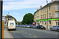
2008 : Bear Flat, Bath
Bear Flat gives a short but welcome relief to travellers on the A367 out of Bath on the way to Wells. Starting at the southern end of Southgate Street the A367 climbs the hill as Wells Road then on turning the corner seen here onto Bear Flat it becomes Wellsway.
Image: © Maurice Pullin
Taken: 24 Jul 2008
0.02 miles
3

2008 : Post Office and shops on Bear Flat, Bath
A few yards north from Image] (now being refurbished) we find these shops, a Post Office and a surveillance camera.
Image: © Maurice Pullin
Taken: 24 Jul 2008
0.03 miles
4
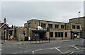
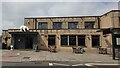
The Bear, Wellsway, Bath
Decent modern pub rather resembling a post-war estate pub, though someone forgot to build the estate.
Note the large polar bear above the entrance.
Image: © Stephen Richards
Taken: 17 Jun 2018
0.03 miles
7
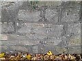
Ordnance Survey Cut Mark
This OS cut mark can be found on the wall east side of Holloway. It marks a point 70.366m above mean sea level.
Image: © Adrian Dust
Taken: 2 Dec 2022
0.04 miles
8
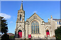
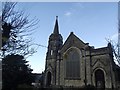
Beechen Cliff Methodist Church
Church in Bear Flat, Bath.
Image: © Wayland Smith
Taken: 26 Feb 2012
0.05 miles
9
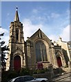
Beechen Cliff Methodist Church
On the steep Shakespeare Avenue, just up from Bear Flat.
Image: © Derek Harper
Taken: 25 Aug 2008
0.05 miles
10
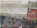
Ordnance Survey Cut Mark
This OS cut mark can be found on No35 Wellsway. It marks a point 74.276m above mean sea level.
Image: © Adrian Dust
Taken: 2 Dec 2022
0.06 miles