
IMAGES TAKEN NEAR TO
Pulteney Road, BATH, BA2 4DG
Introduction
This page details the photographs taken nearby to Pulteney Road, BA2 4DG by members of the Geograph project.
The Geograph project started in 2005 with the aim of publishing, organising and preserving representative images for every square kilometre of Great Britain, Ireland and the Isle of Man.

There are currently over 7.5m images from over14,400 individuals and you can help contribute to the project by visiting https://www.geograph.org.uk
Image Map
Images are licensed for reuse under creativecommons.org/licenses/by-sa/2.0
Notes
- Clicking on the map will re-center to the selected point.
- The higher the marker number, the further away the image location is from the centre of the postcode.
Image Listing (489 Images Found)
Images are licensed for reuse under creativecommons.org/licenses/by-sa/2.0
Image
Details
Distance
1
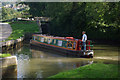
Kennet & Avon Canal, Bath
A narrowboat heads up Bath's flight of six locks.
Image: © Stephen McKay
Taken: 21 Sep 2008
0.01 miles
2
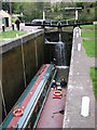
Barges in Lock, Bath
Very deep lock at the end of the canal in Bath.
Image: © don cload
Taken: 23 Apr 2006
0.01 miles
3
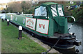
Hobbler, Kennet & Avon Canal
Moored close to Image
Image: © Derek Harper
Taken: 8 Dec 2019
0.01 miles
4
![Wash House Lock and footbridge [1]](https://s0.geograph.org.uk/geophotos/05/80/82/5808244_dbb993e8_120x120.jpg)
Wash House Lock and footbridge [1]
Seen from below, this lock on the Kennet & Avon Canal was built circa 1800 and restored in 1971. The lock is listed, grade II, with details at: https://www.historicengland.org.uk/listing/the-list/list-entry/1395967.
The footbridge, circa 1815, was one of the bridges placed across the new canal to link the recent developments along the slopes of Bathwick Hill with the city. Listed, grade II, with details at: https://www.historicengland.org.uk/listing/the-list/list-entry/1395959
Image: © Michael Dibb
Taken: 2 Jun 2018
0.01 miles
5
![Wash House Lock and footbridge [2]](https://s1.geograph.org.uk/geophotos/05/80/82/5808249_e4e7031b_120x120.jpg)
Wash House Lock and footbridge [2]
Seen from above, this lock on the Kennet & Avon Canal was built circa 1800 and restored in 1971. The lock is listed, grade II, with details at: https://www.historicengland.org.uk/listing/the-list/list-entry/1395967.
The footbridge, circa 1815, was one of the bridges placed across the new canal to link the recent developments along the slopes of Bathwick Hill with the city. Listed, grade II, with details at: https://www.historicengland.org.uk/listing/the-list/list-entry/1395959
Image: © Michael Dibb
Taken: 2 Jun 2018
0.02 miles
6
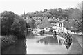
The Kennet & Avon at Bath
Taken from the bridge carrying Pulteney Gardens over the canal. St Luke's church is visible in the background.
Image: © John Winder
Taken: 9 Nov 2016
0.03 miles
7
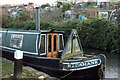
Redshank, Kennet & Avon Canal
The stern of the craft shown in Image, here moored near Wash House Lock. Across the canal are Abbey View Allotments.
Image: © Derek Harper
Taken: 8 Dec 2019
0.03 miles
8
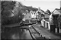
Kennet & Avon, Bath
The canal turns sharp right here, shortly before locking down onto the navigable section of the River Avon.
Image: © John Winder
Taken: 9 Nov 2016
0.03 miles
9
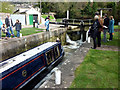
Kennet and Avon Canal, Bath
Filling up the lock.
Image: © John Sparshatt
Taken: 4 Apr 2010
0.03 miles
10
![Bath Deep Lock [No 8/9], Kennet & Avon Canal](https://s3.geograph.org.uk/geophotos/04/48/29/4482991_d97bb594_120x120.jpg)
Bath Deep Lock [No 8/9], Kennet & Avon Canal
Seen from a departing boat. This modern lock replaces two original ones, hence its mighty depth - 19 feet 5 inches [5.6 metres].
Image: © Christine Johnstone
Taken: 3 May 2015
0.03 miles