
IMAGES TAKEN NEAR TO
Triangle Villas, BATH, BA2 3JF
Introduction
This page details the photographs taken nearby to Triangle Villas, BA2 3JF by members of the Geograph project.
The Geograph project started in 2005 with the aim of publishing, organising and preserving representative images for every square kilometre of Great Britain, Ireland and the Isle of Man.

There are currently over 7.5m images from over14,400 individuals and you can help contribute to the project by visiting https://www.geograph.org.uk
Image Map
Images are licensed for reuse under creativecommons.org/licenses/by-sa/2.0
Notes
- Clicking on the map will re-center to the selected point.
- The higher the marker number, the further away the image location is from the centre of the postcode.
Image Listing (193 Images Found)
Images are licensed for reuse under creativecommons.org/licenses/by-sa/2.0
Image
Details
Distance
1
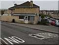
Triangle Launderette, Bath
At 1 Triangle West.
Image: © Jaggery
Taken: 11 Mar 2017
0.01 miles
2
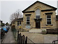
Oldfield Park Baptist Church Hall, Bath
On the corner of Moorland Road and Triangle East, the hall is part of this Grade II listed Edwardian church building http://www.geograph.org.uk/photo/5308077
Image: © Jaggery
Taken: 11 Mar 2017
0.02 miles
3
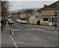
No Entry signs, Moorland Road, Bath
Facing the Triangle North and Triangle West junctions. Triangle Launderette http://www.geograph.org.uk/photo/5307926 is on the right.
Image: © Jaggery
Taken: 11 Mar 2017
0.02 miles
4
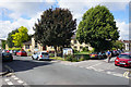
Oldfield Park Baptist Church
The view of it is a bit obscured by the ornamental trees.
Image: © Bill Boaden
Taken: 29 Jul 2016
0.03 miles
5
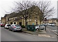
Two telecoms cabinets on a Bath corner
The dark green cabinets are on the corner of Triangle North and Moorland Road.
Image: © Jaggery
Taken: 11 Mar 2017
0.03 miles
6
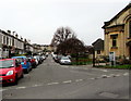
Triangle East towards Moorland Road, Oldfield Park, Bath
Viewed from Triangle North. Oldfield Park Baptist Church http://www.geograph.org.uk/photo/5308077 is on the right.
Image: © Jaggery
Taken: 11 Mar 2017
0.03 miles
7
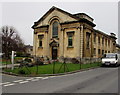
Oldfield Park Baptist Church, Bath
Located in The Triangle, the Edwardian (1902) church was Grade II listed in 2011.
Image: © Jaggery
Taken: 11 Mar 2017
0.04 miles
8
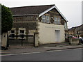
Kingdom Hall of Jehovah's Witnesses, Oldfield Park, Bath
At 57A Triangle North. Jehovah's Witnesses use Kingdom Hall for their places of worship because the biblical use of church usually refers to the congregation of people rather than a structure.
Image: © Jaggery
Taken: 11 Mar 2017
0.04 miles
9
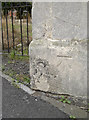
Benchmark in West Avenue
A cut mark (as described in the Benchmark Database: http://www.bench-marks.org.uk/bm39809 ), on the end of a house beside the converted church. See Image] for a wider view of the roadworks currently going on to rebuild the small bridge over the railway.
Image: © Neil Owen
Taken: 17 Oct 2011
0.05 miles
10
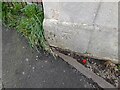
Ordnance Survey Cut Mark
This OS cut mark can be found on No110 West Avenue. It marks a point 29.307m above mean sea level.
Image: © Adrian Dust
Taken: 3 Dec 2022
0.05 miles