
IMAGES TAKEN NEAR TO
Windsor Bridge Road, BATH, BA2 3DT
Introduction
This page details the photographs taken nearby to Windsor Bridge Road, BA2 3DT by members of the Geograph project.
The Geograph project started in 2005 with the aim of publishing, organising and preserving representative images for every square kilometre of Great Britain, Ireland and the Isle of Man.

There are currently over 7.5m images from over14,400 individuals and you can help contribute to the project by visiting https://www.geograph.org.uk
Image Map
Images are licensed for reuse under creativecommons.org/licenses/by-sa/2.0
Notes
- Clicking on the map will re-center to the selected point.
- The higher the marker number, the further away the image location is from the centre of the postcode.
Image Listing (143 Images Found)
Images are licensed for reuse under creativecommons.org/licenses/by-sa/2.0
Image
Details
Distance
1
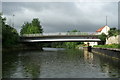
Windsor Bridge, River Avon, Bath
Road bridge linking Lower Weston and East Twerton, view downstream.
Image: © Pierre Terre
Taken: 20 May 2006
0.03 miles
2

River Avon below Windsor Bridge
Looking upstream to the footbridge side of the bridge, with Lansdown Image on the skyline.
Image: © Pierre Terre
Taken: 21 May 2006
0.03 miles
3
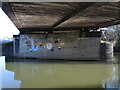
Keeping their cans dry
Some entrepid artists have suffered a little for their art. The old Midland railway bridge is still present even though the trains have long since reached the terminus.
Image: © Neil Owen
Taken: 20 Jan 2023
0.03 miles
4

The River Avon
Looking downstream from the footpath on the north bank near Windsor Bridge. The bridge in the distance carried the Midland Railway's Mangotsfield and Bath Branch Line which closed to passengers in 1966 and to goods in 1971.
Image: © Michael Dibb
Taken: 2 Jun 2018
0.03 miles
5
![Railway bridge [No 205] from the west](https://s2.geograph.org.uk/geophotos/04/48/36/4483690_dedfe66e_120x120.jpg)
Railway bridge [No 205] from the west
Crossing the River Avon, near East Twerton, Bath.
Image: © Christine Johnstone
Taken: 3 May 2015
0.04 miles
6
![Old and new [1]](https://s0.geograph.org.uk/geophotos/05/81/05/5810576_e6cea38d_120x120.jpg)
Old and new [1]
Seen from the footpath on the north bank of the River Avon. The bridge carried the Midland Railway's Mangotsfield and Bath Branch Line which closed to passengers in 1966 and to goods in 1971. New housing development nearby.
Image: © Michael Dibb
Taken: 2 Jun 2018
0.04 miles
7
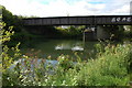
Disused railway bridge over the Avon
This disused railway bridge used to carry the Bath & Bristol Railway over the River Avon near Weston to the west of the city of Bath.
Image: © Philip Halling
Taken: 1 Sep 2007
0.04 miles
8
![Old and new [2]](https://s3.geograph.org.uk/geophotos/05/81/05/5810579_f2d32900_120x120.jpg)
Old and new [2]
Seen from the footpath on the north bank of the River Avon looking upstream. The bridge carried the Midland Railway's Mangotsfield and Bath Branch Line which closed to passengers in 1966 and to goods in 1971. New housing development nearby.
Image: © Michael Dibb
Taken: 2 Jun 2018
0.05 miles
9
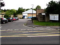
Entrance to Roseberry Place Industrial Units, Bath
From the north side of Lower Bristol Road, viewed from the corner of Bellotts Road.
The board on the right shows nine unit numbers and the business name occupying each one.
Image: © Jaggery
Taken: 6 Jun 2015
0.05 miles
10
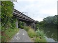
Former railway bridge over River Avon, East Twerton
Seen from the cycle path by the river
Image: © David Smith
Taken: 7 Jul 2016
0.05 miles