
IMAGES TAKEN NEAR TO
Frome Road, BATH, BA2 2QD
Introduction
This page details the photographs taken nearby to Frome Road, BA2 2QD by members of the Geograph project.
The Geograph project started in 2005 with the aim of publishing, organising and preserving representative images for every square kilometre of Great Britain, Ireland and the Isle of Man.

There are currently over 7.5m images from over14,400 individuals and you can help contribute to the project by visiting https://www.geograph.org.uk
Image Map
Images are licensed for reuse under creativecommons.org/licenses/by-sa/2.0
Notes
- Clicking on the map will re-center to the selected point.
- The higher the marker number, the further away the image location is from the centre of the postcode.
Image Listing (10 Images Found)
Images are licensed for reuse under creativecommons.org/licenses/by-sa/2.0
Image
Details
Distance
1
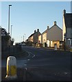
Old Fosse Road, Odd Down
Houses facing the morning sunshine, seen from the junction with Frome Road.
Image: © Derek Harper
Taken: 16 Feb 2016
0.05 miles
2
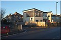
New building, Frome Road, Odd Down
On the corner of Barrow Road. A building of five flats, built in 2013.
Image: © Derek Harper
Taken: 16 Feb 2016
0.09 miles
3
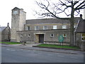
St. Philip & St. James, Odd Down
A view looking north towards the church of St. Philip and St. James at Odd Down.
Image: © Phil Williams
Taken: 31 Mar 2006
0.10 miles
4
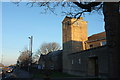
St Philip & St James church, Odd Down
On Frome Road (busy just before 8am on a frosty morning), and also shown in Image
Image: © Derek Harper
Taken: 16 Feb 2016
0.14 miles
5
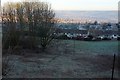
View from Rush Hill
From the junction with Summerdale View / Somerdale View (both spellings appear on maps). The houses across the open hillside are on Edgeworth Road.
Image: © Derek Harper
Taken: 16 Feb 2016
0.16 miles
6
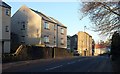
Rush Hill
A busy road, momentarily free of traffic, here descending from Odd Down past a cul-de-sac of the same name, and housing old and new.
Image: © Derek Harper
Taken: 16 Feb 2016
0.17 miles
7
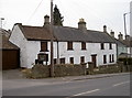
Another case of 'Time gentlemen, please!'
The old Rose and Laurel on Rush Hill has now closed its doors. It is up for sale, although the prospects for this old inn seem uncertain in these pressing times. See Maurice Pullin's shot of 2008 Image] for an earlier view.
Image: © Neil Owen
Taken: 9 Feb 2012
0.18 miles
8
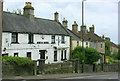
2008 : The Rose and Laurel, Rush Hill
Well positioned about half way up Rush Hill.
An old country inn now swallowed by Bath suburbs.
The Rose and the Laurel is the quick march of the British Armed Forces Intelligence Corps. They know a thing or two.
The bold red shield under the eaves tells us this is an "Ushers" house.
Image: © Maurice Pullin
Taken: 10 Jul 2008
0.21 miles
9

2008 : The Bread Basket, Odd Down
Sandwiches as well, freshly cut and toasted - yummy.
Image: © Maurice Pullin
Taken: 10 Jul 2008
0.23 miles
10
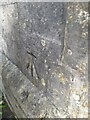
Ordnance Survey Cut Mark
This OS cut mark can be found on No380 Bloomfield Road. It marks a point 168.604m above mean sea level.
Image: © Adrian Dust
Taken: 16 Nov 2022
0.24 miles