
IMAGES TAKEN NEAR TO
The Oval, BATH, BA2 2HF
Introduction
This page details the photographs taken nearby to The Oval, BA2 2HF by members of the Geograph project.
The Geograph project started in 2005 with the aim of publishing, organising and preserving representative images for every square kilometre of Great Britain, Ireland and the Isle of Man.

There are currently over 7.5m images from over14,400 individuals and you can help contribute to the project by visiting https://www.geograph.org.uk
Image Map
Images are licensed for reuse under creativecommons.org/licenses/by-sa/2.0
Notes
- Clicking on the map will re-center to the selected point.
- The higher the marker number, the further away the image location is from the centre of the postcode.
Image Listing (21 Images Found)
Images are licensed for reuse under creativecommons.org/licenses/by-sa/2.0
Image
Details
Distance
1
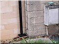
Ordnance Survey Cut Mark
This OS cut mark can be found on No104 The Oval. It marks a point 80.625m above mean sea level.
Image: © Adrian Dust
Taken: 2 Dec 2022
0.02 miles
2
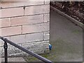
Ordnance Survey Cut Mark
This OS cut mark can be found on No119 The Oval. It marks a point 74.867m above mean sea level.
Image: © Adrian Dust
Taken: 2 Dec 2022
0.05 miles
3
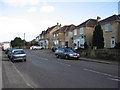
Englishcombe Lane
A view looking east along Englishcombe Lane, showing a small parade of shops on the right.
Image: © Phil Williams
Taken: 9 Mar 2007
0.09 miles
4
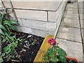
Ordnance Survey Cut Mark
This OS cut mark can be found on No66 The Oval. It marks a point 72.222m above mean sea level.
Image: © Adrian Dust
Taken: 2 Dec 2022
0.10 miles
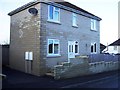
6
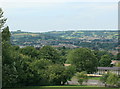
2008 : North west from Englishcombe Lane
Turning west a little from Image] gives a view over Newbridge to Kelston Round Hill Image Further right we are looking across Weston to Lansdown.
Image: © Maurice Pullin
Taken: 24 Jul 2008
0.12 miles
7
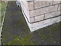
Ordnance Survey Cut Mark
This OS cut mark can be found on No38 The Oval. It marks a point 74.615m above mean sea level.
Image: © Adrian Dust
Taken: 2 Dec 2022
0.13 miles
8
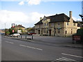
The Englishcombe Inn
A view looking east across Englishcombe Lane towards the Englishcombe Inn.
Image: © Phil Williams
Taken: 9 Mar 2007
0.13 miles
9
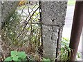
Ordnance Survey Cut Mark
This OS cut mark can be found on the concrete post NW side of Monksdale Road. It marks a point 57.067m above mean sea level.
Image: © Adrian Dust
Taken: 2 Dec 2022
0.16 miles
