
IMAGES TAKEN NEAR TO
Carrs Close, BATH, BA2 1TA
Introduction
This page details the photographs taken nearby to Carrs Close, BA2 1TA by members of the Geograph project.
The Geograph project started in 2005 with the aim of publishing, organising and preserving representative images for every square kilometre of Great Britain, Ireland and the Isle of Man.

There are currently over 7.5m images from over14,400 individuals and you can help contribute to the project by visiting https://www.geograph.org.uk
Image Map
Images are licensed for reuse under creativecommons.org/licenses/by-sa/2.0
Notes
- Clicking on the map will re-center to the selected point.
- The higher the marker number, the further away the image location is from the centre of the postcode.
Image Listing (43 Images Found)
Images are licensed for reuse under creativecommons.org/licenses/by-sa/2.0
Image
Details
Distance
1
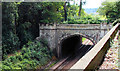
Brunel's Southern Railway Bridge in Twerton, Bath
In the 1840s, Isambard Kingdom Brunel brought his famous Great Western Railway through two Gothic style tunnels beside Carr's wood.
There was no structural reason to build the southernmost one - it was ordered simply to hide the railway from the view of Wood House, owned by Mr Carr Image
Image: © Rick Crowley
Taken: 29 Jul 2020
0.06 miles
2
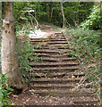
Twerton, Bath. Remains of Wood House
Wood House designed and built in 1838 for Charles Wilkins by Bath architect Edward Davis, and then owned by the Carr family who also owned Twerton Woollen Factories on the island in the river Avon which is now a bus depot. Today, flats stand on the site of the old house. The Carr family opened their grounds for a popular flower show each year.
Stone stairs still visible today are shown here, these once led from the terrace at the back of the house down into the wood. Think how many people must have walked on them in the mid nineteenth century.
Image: © Rick Crowley
Taken: 29 Jul 2020
0.08 miles
3
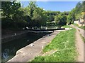
Kennet & Avon Canal Walk
Kennet & Avon Canal Walk heading past the Weston Lock No 6
Image: © Shaun Ferguson
Taken: 5 May 2018
0.09 miles
4

Brassmill Lane Park
A bit of green space for a game. The goals seem full size, but the distance between them is barely half a normal pitch.
Image: © Neil Owen
Taken: 20 Jan 2023
0.11 miles
5

Hope Cottage, Twerton
Seen from the churchyard and facing Watery Lane across How Hill, the detached cottage is listed https://historicengland.org.uk/listing/the-list/list-entry/1395902 .
Image: © Derek Harper
Taken: 9 Dec 2019
0.11 miles
6
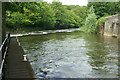
Below Weston Lock, River Avon
The landing stage for crew to re-board after working Weston Lock gates. The main river joins from the left over the weir Image
Image: © Pierre Terre
Taken: 20 May 2006
0.12 miles
7
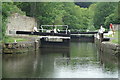
Weston Lock, Weston, Bath
At the bottom end of Weston Cut boats rejoin the main river through Weston Lock
Image: © Pierre Terre
Taken: 20 May 2006
0.12 miles
8
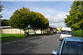
Brassmill Lane
The road has industrial units to the left and a residential estate to the right.
Image: © Bill Boaden
Taken: 28 Sep 2017
0.12 miles
9
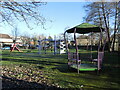
Brassmill Lane - for the kids
Some equipment to expend some energy on.
Image: © Neil Owen
Taken: 20 Jan 2023
0.12 miles
10

Trees, Twerton churchyard
Near the northwest corner of the churchyard.
Image: © Derek Harper
Taken: 9 Dec 2019
0.13 miles