
IMAGES TAKEN NEAR TO
Albany Road, BATH, BA2 1BP
Introduction
This page details the photographs taken nearby to Albany Road, BA2 1BP by members of the Geograph project.
The Geograph project started in 2005 with the aim of publishing, organising and preserving representative images for every square kilometre of Great Britain, Ireland and the Isle of Man.

There are currently over 7.5m images from over14,400 individuals and you can help contribute to the project by visiting https://www.geograph.org.uk
Image Map
Images are licensed for reuse under creativecommons.org/licenses/by-sa/2.0
Notes
- Clicking on the map will re-center to the selected point.
- The higher the marker number, the further away the image location is from the centre of the postcode.
Image Listing (83 Images Found)
Images are licensed for reuse under creativecommons.org/licenses/by-sa/2.0
Image
Details
Distance
1
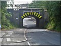
Mind your head
At only 6feet 6 inches this is very low headroom on a public road. The bridge carries the railway line between Bath and Bristol over Jews Lane.
Image: © Michael Dibb
Taken: 2 Jun 2018
0.04 miles
2
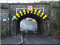
Jews Lane bridge
A single lane for road traffic, the main line to Bath Spa station above.
Image: © Neil Owen
Taken: 20 Jan 2023
0.04 miles
3
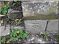
Ordnance Survey Cut Mark
This OS cut mark can be found on the wall of No1 Lansdown View. It marks a point 21.819m above mean sea level.
Image: © Adrian Dust
Taken: 3 Dec 2022
0.05 miles
4
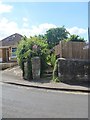
Start of path
From Lansdown View, the path runs to Loxton Drive.
Image: © Michael Dibb
Taken: 2 Jun 2018
0.05 miles
5
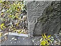
Ordnance Survey Cut Mark
This OS cut mark can be found on the west face of the railway bridge on Jews Lane. It marks a point 21.290m above mean sea level.
Image: © Adrian Dust
Taken: 3 Dec 2022
0.05 miles
6
![The Golden Fleece [2]](https://s0.geograph.org.uk/geophotos/05/81/15/5811536_8a8d1f31_120x120.jpg)
The Golden Fleece [2]
A public house on the corner of Lower Bristol Road and Fielding's Road.
Image: © Michael Dibb
Taken: 2 Jun 2018
0.07 miles
7
![The Golden Fleece [1]](https://s2.geograph.org.uk/geophotos/05/81/15/5811522_3981c57a_120x120.jpg)
The Golden Fleece [1]
A public house on the corner of Lower Bristol Road and Fielding's Road.
Image: © Michael Dibb
Taken: 2 Jun 2018
0.07 miles
8

Engineering Works, Twerton
Hi-tech engineering works on the south bank of the Avon below Halfpenny Bridge.
Image: © Pierre Terre
Taken: 21 May 2006
0.07 miles
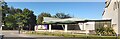
10
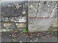
Ordnance Survey Cut Mark
This OS cut mark can be found on the gatepost of No39 Lansdown View. It marks a point 37.051m above mean sea level.
Image: © Adrian Dust
Taken: 3 Dec 2022
0.09 miles