
IMAGES TAKEN NEAR TO
Lymore Avenue, BATH, BA2 1AY
Introduction
This page details the photographs taken nearby to Lymore Avenue, BA2 1AY by members of the Geograph project.
The Geograph project started in 2005 with the aim of publishing, organising and preserving representative images for every square kilometre of Great Britain, Ireland and the Isle of Man.

There are currently over 7.5m images from over14,400 individuals and you can help contribute to the project by visiting https://www.geograph.org.uk
Image Map
Images are licensed for reuse under creativecommons.org/licenses/by-sa/2.0
Notes
- Clicking on the map will re-center to the selected point.
- The higher the marker number, the further away the image location is from the centre of the postcode.
Image Listing (43 Images Found)
Images are licensed for reuse under creativecommons.org/licenses/by-sa/2.0
Image
Details
Distance
1
![The view from the bridge [2]](https://s1.geograph.org.uk/geophotos/05/81/25/5812553_f916b1b2_120x120.jpg)
The view from the bridge [2]
Looking south along Dartmouth Avenue from the bridge carrying the Two Tunnels Greenway over the road.
The Greenway is the former trackbed of the Somerset & Dorset Joint Railway which ran from Bath to Bournemouth. The heavily engineered railway closed in 1966. Part of the trackbed became a linear park whilst further south it was used as an informal footpath. A campaign to re-open the route as a shared-use path started in 2005 and the Two Tunnels Greenway opened in April, 2013.
Image: © Michael Dibb
Taken: 2 Jun 2018
0.10 miles
2
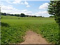
Playing fields
The fields are just off Dartmouth Avenue.
Image: © Michael Dibb
Taken: 2 Jun 2018
0.12 miles
3

Ordnance Survey Cut Mark
This OS cut mark can be found on the White Horse PH. It marks a point 49.738m above mean sea level.
Image: © Adrian Dust
Taken: 3 Dec 2022
0.12 miles
4
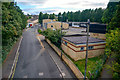
Bath : Dartmouth Avenue
Looking down to Dartmouth Avenue.
Image: © Lewis Clarke
Taken: 6 Aug 2020
0.14 miles
5
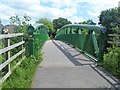
Over the road
The bridge carries the Two Tunnels Greenway over Millmead Road (north) and Dartmouth Avenue (south).
The Greenway is the former trackbed of the Somerset & Dorset Joint Railway which ran from Bath to Bournemouth. The heavily engineered railway closed in 1966. Part of the trackbed became a linear park whilst further south it was used as an informal footpath. A campaign to re-open the route as a shared-use path started in 2005 and the Two Tunnels Greenway opened in April, 2013.
Image: © Michael Dibb
Taken: 2 Jun 2018
0.15 miles
6
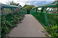
Bath : Two Tunnels Greenway
Looking along the footpath over Dartmouth Avenue.
Image: © Lewis Clarke
Taken: 6 Aug 2020
0.15 miles
7
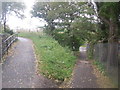
Pathways split into 2
A recently constructed bridge can be seen in the distance to the left, while the old footpath carries straight on.
Image: © Robert Gourley
Taken: 30 Oct 2013
0.16 miles
9
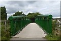
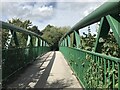
Cycle bridge over Millmead Road, South Twerton
Part of the Two Tunnels Greenway cycle route
Image: © David Smith
Taken: 7 Jul 2016
0.17 miles
10
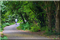
Bath : Two Tunnels Greenway
The footpath heads through Bath.
Image: © Lewis Clarke
Taken: 6 Aug 2020
0.17 miles