
IMAGES TAKEN NEAR TO
Meadgate, BATH, BA2 0NQ
Introduction
This page details the photographs taken nearby to Meadgate, BA2 0NQ by members of the Geograph project.
The Geograph project started in 2005 with the aim of publishing, organising and preserving representative images for every square kilometre of Great Britain, Ireland and the Isle of Man.

There are currently over 7.5m images from over14,400 individuals and you can help contribute to the project by visiting https://www.geograph.org.uk
Image Map
Images are licensed for reuse under creativecommons.org/licenses/by-sa/2.0
Notes
- Clicking on the map will re-center to the selected point.
- The higher the marker number, the further away the image location is from the centre of the postcode.
Image Listing (17 Images Found)
Images are licensed for reuse under creativecommons.org/licenses/by-sa/2.0
Image
Details
Distance
1
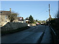
2009 : B3115 at Meadgate West near Timsbury
Seen from Weekesley Lane.
The B3115 comes in from the left at the junction and continues straight ahead through Meadgate West, Meadgate East and Tunley.
Image: © Maurice Pullin
Taken: 20 Dec 2009
0.01 miles
2
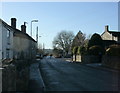
2009 : B3115 south west at Meadgate West
The B3115 takes a turn to the right through Timsbury. The road straight ahead is Weeksley Road, a minor road going through Radford and Paulton.
Image: © Maurice Pullin
Taken: 20 Dec 2009
0.02 miles
3
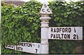
Direction Sign - Signpost by the B3115, Meadgate West
Pyramid finial - 2 arms; Somerset SCC pyramid by the B3115, in parish of Camerton (Bath And North East Somerset District), Weekesley Lane junction, Meadgate West.
Surveyed
Milestone Society National ID: SO_ST6758.
Image: © Milestone Society
Taken: Unknown
0.02 miles
4
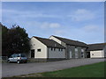
Camerton Community Hall
Formerly Camerton Recreation Centre. There is evidence inside of the area's mining past. https://www.camertoncommunityhall.co.uk/
Image: © HelenK
Taken: 8 Sep 2007
0.03 miles
5
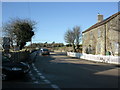
2009 : B3115 about to enter Timsbury at Meadgate West
Weeksley Lane from Radford enters on the left.
The road rises through Hook before it comes to Timsbury High Street.
Image: © Maurice Pullin
Taken: 20 Dec 2009
0.05 miles
7
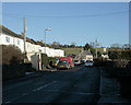
2009 : B3115 at Meadgate West
Heading east through the main part of the hamlet.
Soon to climb Tunley Hill, seen ahead.
Image: © Maurice Pullin
Taken: 20 Dec 2009
0.07 miles
8
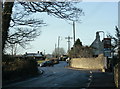
2009 : B3115 at Meadgate East
Camerton Road leaves to the left, Meadgate West is immediately beyond then on to Timsbury.
Image: © Maurice Pullin
Taken: 20 Dec 2009
0.13 miles
9
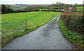
Drive to the Folly
Seen from the B3115 Hook Hill. Two footpaths diverge in this image; CL 21/39 follows the drive and passes the house, while CL 21/41 cuts diagonally across the field on the left, stating from the gate on the left, and goes through the gap in the hedge in the centre, where it crosses another footpath.
Image: © Derek Harper
Taken: 6 Dec 2019
0.15 miles
10
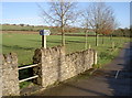
Choose your path
A couple of footpaths for a traveller's delight. The right-hand path goes down to Sheep House Farm and the old workings; the left goes up the hill to Meadgate - although you might as well just walk up the road!
Image: © Neil Owen
Taken: 11 Jan 2013
0.18 miles