
IMAGES TAKEN NEAR TO
Lansdown View, BATH, BA2 0JP
Introduction
This page details the photographs taken nearby to Lansdown View, BA2 0JP by members of the Geograph project.
The Geograph project started in 2005 with the aim of publishing, organising and preserving representative images for every square kilometre of Great Britain, Ireland and the Isle of Man.

There are currently over 7.5m images from over14,400 individuals and you can help contribute to the project by visiting https://www.geograph.org.uk
Image Map
Images are licensed for reuse under creativecommons.org/licenses/by-sa/2.0
Notes
- Clicking on the map will re-center to the selected point.
- The higher the marker number, the further away the image location is from the centre of the postcode.
Image Listing (37 Images Found)
Images are licensed for reuse under creativecommons.org/licenses/by-sa/2.0
Image
Details
Distance
1
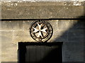
The cross of St John
Central motif on the old Temperance Hall. See Image] for a wider view.
Image: © Neil Owen
Taken: 9 Feb 2015
0.06 miles
2
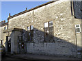
The old Temperance Hall
The Temperance Movement built this hall in 1844, which is now occupied by the St John's Ambulance organisation. Next door was the caretaker's house. See Image] for a closer look at the emblem.
Image: © Neil Owen
Taken: 9 Feb 2015
0.06 miles
3
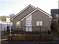
Y.M.C.A. for village people
Timsbury has a place for many activities: fitness, dance, pilates and theatrical classes to name a few.
Image: © Neil Owen
Taken: 9 Feb 2015
0.08 miles
4

Toposcopic sheepfield
An unexpected but pleasing find on North Road - a toposcope. The sheep aren't on the diagram; instead, the horizon is named as Farmborough Common, Bath racecourse and the landmark of Beckford Tower. The plate is illustrated by Barbara Green and supported by a number of local and national concerns.
Image: © Neil Owen
Taken: 9 Feb 2015
0.09 miles
5

Public sheep path
The land adjoining the school is home to a flock of rather unfazed sheep. Walkers on the footpath to Park Way Lane will have to watch put for the young tupps.
Image: © Neil Owen
Taken: 9 Feb 2015
0.09 miles
6
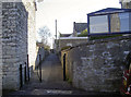
Chapel Walk
Adjoins the Tabor Church; the path bollards might not be terribly effective in preventing wheeled traffic.
Image: © Neil Owen
Taken: 9 Feb 2015
0.10 miles
7

Tabor Free Methodist Church, Timsbury
Shown from another angle in Image http://www.timsbury.org.uk/history-tabor-church/ .
Image: © Derek Harper
Taken: 9 Dec 2019
0.11 miles
8
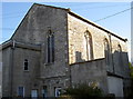
Timsbury Tabor church
The Tabor church opened for worship in 1865; interestingly enough, the pews and stained glass windows were created locally. Thomas Smith (windows) and Valentine Keeling (pews and screens) both had businesses in The Square. In 1930 a formal union with the Methodist Union Circuit was turned down and so the church remains a Free Church to this day.
A benchmark can be found on the roadside face - see Image
Image: © Neil Owen
Taken: 9 Feb 2015
0.11 miles
9

Tabor benchmark
A cutmark, as listed in the Benchmark Database: http://www.bench-marks.org.uk/bm64181 , on the Tabor Church in North Road. See Image] for a wider view.
Image: © Neil Owen
Taken: 9 Feb 2015
0.11 miles
10
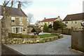
Houses on Chapel Walk, Timsbury
New houses close to Image
Image: © Derek Harper
Taken: 9 Dec 2019
0.12 miles